
Population 233 (2000) | Area 56.66 km² | |
 | ||
Length 9.5 mi (15.3 km) measured SW–NE Width 3.0 mi (4.8 km) measured SE–NW Official website www.regionalparks.saccounty.net/Parks/SacramentoRiverandDelta/Pages/ShermanIsland.aspx Similar Sacramento–San Joaquin River Delta, Brannan Island State Rec, Antioch Bridge, Contra Loma Regional, Montezuma Hills | ||
Sherman Island is an island in the Sacramento-San Joaquin River Delta at the confluence of the two rivers in Sacramento County, California, two kilometres northeast of Antioch. The 5,500 ha (14,000 acres) island is the meeting point of Sacramento-, Solano-, and Contra Costa-Counties, and is bordered on the north and northwest by the Sacramento River, on the northeast by Three Mile Slough, and on the east, and south west by the San Joaquin River.
Map of Sherman Island, California 94571, USA
Access to the island is provided by California State Route 160, which uses the Antioch Bridge to link Sherman Island with the city of Antioch to the south, and the Three Mile Slough Bridge to link Sherman Island with Brannan Island State Recreation Area to the north.
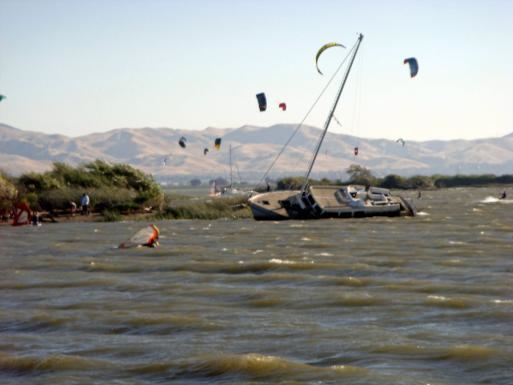
The southwest of the island features a large marshy area and Sherman Lake where there is fishing and other water sports, particularly windsurfing and kite boarding.