
Congressional district At-large Website www.sheridancounty.com Founded 1888 | Largest city Sheridan Area 6,545 km² Population 29,824 (2013) University Sheridan College | |
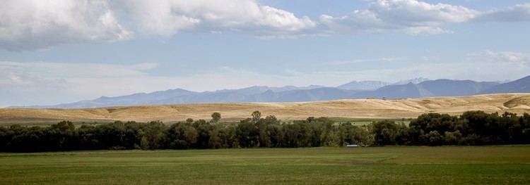 | ||
Points of interest Bighorn National Forest, Kendrick Park, The Brinton Museum, Trail End, Sheridan County Museum | ||
Sheridan County is a county located in the U.S. state of Wyoming. As of the 2010 census, the population was 29,116. The county seat is Sheridan. It is south from the Montana state line.
Contents
- Map of Sheridan County WY USA
- History
- Geography
- Adjacent counties
- Major highways
- National protected area
- 2000 census
- 2010 census
- Government and infrastructure
- City
- Towns
- Census designated places
- Unincorporated communities
- References
Map of Sheridan County, WY, USA
Sheridan County comprises the Sheridan, WY Micropolitan Statistical Area.
History
Sheridan County was created by the legislature of the Wyoming Territory on March 9, 1888. The county was formed from land ceded from Johnson County. Sheridan County was named for Philip Sheridan, a general in the American Civil War and controversial Indian fighter.
In 1897, Big Horn County was created by removing lands from Sheridan County, along with lands from Fremont County, and Johnson County. The boundaries of Sheridan County were slightly modified in 1911 and 1929, but have remained stable since then.
Geography
According to the U.S. Census Bureau, the county has a total area of 2,527 square miles (6,540 km2), of which 2,524 square miles (6,540 km2) is land and 3.1 square miles (8.0 km2) (0.1%) is water.
Adjacent counties
Major highways
National protected area
2000 census
As of the census of 2000, there were 26,560 people, 11,167 households, and 7,079 families residing in the county. The population density was 10/sq mi (4/km²). There were 12,577 housing units at an average density of 5/sq mi (2/km²). The racial makeup of the county was 95.88% White, 0.18% Black or African American, 1.27% Native American, 0.38% Asian, 0.12% Pacific Islander, 0.82% from other races, and 1.34% from two or more races. 2.43% of the population were Hispanic or Latino of any race. 24.8% were of German, 12.3% English, 10.3% Irish, 7.1% American, 6.0% Norwegian and 5.1% Polish ancestry.
There were 11,167 households out of which 28.40% had children under the age of 18 living with them, 52.00% were married couples living together, 8.20% had a female householder with no husband present, and 36.60% were non-families. 30.90% of all households were made up of individuals and 12.50% had someone living alone who was 65 years of age or older. The average household size was 2.31 and the average family size was 2.90.
In the county, the population was spread out with 24.10% under the age of 18, 8.00% from 18 to 24, 25.30% from 25 to 44, 27.10% from 45 to 64, and 15.50% who were 65 years of age or older. The median age was 41 years. For every 100 females there were 95.90 males. For every 100 females age 18 and over, there were 94.00 males.
The median income for a household in the county was $34,538, and the median income for a family was $42,669. Males had a median income of $31,381 versus $20,354 for females. The per capita income for the county was $19,407. About 8.60% of families and 10.70% of the population were below the poverty line, including 14.40% of those under age 18 and 6.40% of those age 65 or over.
2010 census
As of the 2010 United States Census, there were 29,116 people, 12,360 households, and 7,701 families residing in the county. The population density was 11.5 inhabitants per square mile (4.4/km2). There were 13,939 housing units at an average density of 5.5 per square mile (2.1/km2). The racial makeup of the county was 95.4% white, 1.2% American Indian, 0.7% Asian, 0.4% black or African American, 0.1% Pacific islander, 0.7% from other races, and 1.5% from two or more races. Those of Hispanic or Latino origin made up 3.5% of the population. In terms of ancestry, 31.5% were German, 16.3% were Irish, 11.8% were English, 7.5% were American, 6.2% were Norwegian, and 5.1% were Polish.
Of the 12,360 households, 27.5% had children under the age of 18 living with them, 49.8% were married couples living together, 8.4% had a female householder with no husband present, 37.7% were non-families, and 30.9% of all households were made up of individuals. The average household size was 2.27 and the average family size was 2.84. The median age was 41.9 years.
The median income for a household in the county was $48,141 and the median income for a family was $61,959. Males had a median income of $45,035 versus $30,780 for females. The per capita income for the county was $26,756. About 5.2% of families and 8.5% of the population were below the poverty line, including 8.1% of those under age 18 and 7.2% of those age 65 or over.
Government and infrastructure
The Wyoming Department of Family Services Juvenile Services Division operates the Wyoming Girls' School, located in unincorporated Sheridan County, near Sheridan. The facility was operated by the Wyoming Board of Charities and Reform until that agency was dissolved as a result of a state constitutional amendment passed in November 1990.