
Country United States Incorporated Unknown Local time Saturday 3:19 AM Population 11,696 (2013) | Established 1793 Elevation 449 ft (137 m) Zip code 40165 Mayor Curtis Hockenbury | |
 | ||
Weather 7°C, Wind W at 13 km/h, 81% Humidity | ||
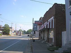
Shepherdsville is a home rule-class city on the Salt River in Bullitt County, Kentucky, in the United States. It is the seat of its county, located just south of Louisville. The population was 11,222 during the 2010 U.S. Census.
Contents
- Map of Shepherdsville KY 40165 USA
- History
- Geography
- Climate
- Demographics
- Education
- Notable people
- References
Map of Shepherdsville, KY 40165, USA
History
American Indians have been shown to have lived in the area for at least 15,000 years.
The vicinity was originally known as "Bullitt's Lick" for the salt licks discovered by surveyor Capt. Thomas Bullitt in 1773. The area was home to Kentucky's first commercial salt works, although these were shuttered in the 1830s by competition from Virginian works along the Kanawha River. Shepherdsville grew up around the mill and store erected along the Salt River by Adam Shepherd, who had purchased 900 acres (360 ha) in the area. The city named for him received its charter in 1793 and became the county seat when Bullitt County was formed in 1796.
The first post office opened in 1806. In 1836, a mineral water spa called Paroquet Springs opened. The mineral water supposedly had medicinal properties, so sufferers from a variety of maladies visited Shepherdsville to drink and bathe in the water. In the mid-1850s, the Louisville and Nashville Railroad's mainline was constructed nearby. During the Civil War, the railroad bridge over the Salt River at Shepherdsville was a potential target for sabotage and was guarded by Union troops. In 1879, the Paroquet Springs hotel burned to the ground, but water from the springs continued to be bottled and sold until 1915. The Lynching of Marie Thompson of Shepherdsville happened in 1904, close at the jail, near Lebanon Junction. The deadliest train wreck in Kentucky history, which killed about fifty people in a two-train collision, took place in Shepherdsville several days before Christmas in 1917.
Throughout most of the 20th century, Shepherdsville was primarily an agricultural area. With the construction of the Kentucky Turnpike (now Interstate 65) in the 1950s, people who worked in Louisville could live outside the city. From then on, Shepherdsville experienced a period of rapid growth.
Geography
Shepherdsville is located on the banks of the Salt River. Downtown Louisville is 20 miles (32 km) to the north via Interstate 65, and Elizabethtown is 26 miles (42 km) to the south.
According to the United States Census Bureau, Shepherdsville has a total area of 10.0 square miles (25.8 km2), of which 9.7 square miles (25.1 km2) is land and 0.31 square miles (0.8 km2), or 3.00%, is water.
Climate
The climate in this area is characterized by hot, humid summers and generally mild to cool winters. According to the Köppen Climate Classification system, Shepherdsville has a humid subtropical climate, abbreviated "Cfa" on climate maps.
Demographics
As of the census of 2000, there were 8,334 people, 3,177 households, and 2,363 families residing in the city. The population density was 791.3 people per square mile (305.6/km²). There were 3,402 housing units at an average density of 323.0 per square mile (124.7/km²). The racial makeup of the city was 97.24% White, 0.92% African American, 0.35% Native American, 0.37% Asian, 0.02% Pacific Islander, 0.12% from other races, and 0.97% from two or more races. Hispanic or Latino of any race were 0.74% of the population.
There were 3,177 households out of which 41.6% had children under the age of 18 living with them, 52.0% were married couples living together, 17.3% had a female householder with no husband present, and 25.6% were non-families. 20.7% of all households were made up of individuals and 7.1% had someone living alone who was 65 years of age or older. The average household size was 2.59 and the average family size was 2.96.
In the city, the population was spread out with 28.9% under the age of 18, 12.2% from 18 to 24, 33.4% from 25 to 44, 17.4% from 45 to 64, and 8.1% who were 65 years of age or older. The median age was 29 years. For every 100 females there were 94.9 males. For every 100 females age 18 and over, there were 90.8 males.
The median income for a household in the city was $36,103, and the median income for a family was $40,878. Males had a median income of $31,324 versus $22,871 for females. The per capita income for the city was $16,519. About 13.7% of families and 15.2% of the population were below the poverty line, including 25.2% of those under age 18 and 8.6% of those age 65 or over.
Education
Area students attend Bullitt County Public Schools. Different sections of the city are zoned to one of the county's three regular public high schools:
The city also houses Riverview High School, the county district's alternative high school for at-risk students.