
OS grid reference SU3673 Local time Saturday 3:48 AM | Sovereign state United Kingdom Postcode district RG17 Dialling code 01488 | |
 | ||
Weather 9°C, Wind S at 18 km/h, 88% Humidity | ||
Shefford Woodlands is a village in West Berkshire, England, about 3 miles (5 km) northeast of the market town of Hungerford. The village is in the civil parish of Great Shefford, about 1 mile (1.6 km) southeast of Great Shefford village. Shefford Woodlands is about 545 feet (166 m) above sea level in the Berkshire Downs, and just north of Junction 14 on the M4.
Contents
Map of Shefford Woodlands, Hungerford, UK
History
Shefford Woodlands developed where the road linking Hungerford and Wantage (later a turnpike, now the A338) crossed the Roman road of Ermin Street linking Silchester and Gloucester.
Woodlands House and the barn next to White House were built in the 18th century. Both are now Grade II listed buildings. The barn is a timber-framed building, originally of six bays, and enlarged in the 19th century.
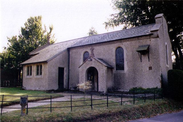
In the 19th and 20th centuries there were significant Wesleyan and Primitive Methodist congregations in Great Shefford parish, and Shefford Woodlands had a Methodist chapel. It fell into disuse, but then in 1911 was consecrated as the Church of England church of St Stephen, making it a dependent chapelry of the parish of St Mary, Great Shefford. Sunday services and St Stephen's are held once a month.
Amenities
The Pheasant Inn and a childcare centre are just outside the village.