
Established 1870 Political status Uyezd Area 2,611.8 verst² | Abolished 1917 Region Caucasus | |
 | ||
Shahur-Daralagezsky Uyezd (Russian: Шарур-Даралагезский уезд) was one of the uyezds (administrative units) of Erivan Governorate of the Russian Empire with its center in Bash Norashen from 1870 until its formal abolition in 1918.
Contents
Geography
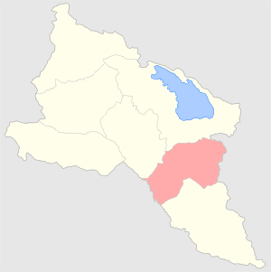
Erivan Governorate consisted of Erivansky, Alexandropolsky, Echmiadzinsky, Nakhchivansky, Novobayazetsky, Surmalinsky, and Sharur-Daralagezsky uyezds. Sharur-Daralagezsky Uyezd was located in the south central part of Erivan Governorate bordering its Erivansky and Novobayazetsky Uyezds in the north, Nakhchivansky in the south, Zangezursky and Javanshirsky uyezds of Elisabethpol Governorate in the east and Persian Empire on the southwest. The area of the uyezd was 2,611.8 square versts (2,972.4 km2). In general, the territory of the uyezd resembled a crater surrounded from the south, north and east by tall mountain ranges of the Lesser Caucasus. The plain which made up a small part of the uyezd was close to Aras river, into which the only river irrigating the plains, Arpa-chay discharged. The mountainous part of the territory was called Daralagoz (Azerbaijani: Daralagöz) and the lowland part was called Sharur (Azerbaijani: Şərur). Sharur constituted only 8.5% of the whole uyezd area. Arpa-chay starts at the southeastern tip of Lake Goycha and flows 107 verst before discharging into Araz, and has many tributaries, Alagoz-chay being the longest. The mountainous part of uyezd, approximately 12,150 desyatins is forested.
History
The territory of the uyezd had been a part of Erivan and Nakhchivan khanates until 1828, when according to Treaty of Turkmenchay, it was annexed to Russian Empire. In 1849, Erivan Governorate made up of Erivansky, Nakhchivansky, Alexandropolsky, Novobayazetsky and Ordubadsky uyezds, was established. Following administrative reforms, the northern part of Nakhchivansky Uyezd was separated to form a new Sharur-Daralagezsky Uyezd in 1870. In 1918-1920, the uyezd disputed between the First Republic of Armenia and the Azerbaijan Democratic Republic. After establishment of Soviet rule in 1920, the territories of the uyezd became part of Armenian SSR and Nakhchivan exclave of Azerbaijan SSR.
Population
According to census held in 1897, the population of uyezd was 76,538, of which 51,560 were Tatars (modern Azerbaijanis), 20,726 were Armenians, 3,761 Kurds, 122 Russians and other minorities. Among 15 rural communities and 161 villages of Sharur-Daralagezsky Uyezd, Tatars made up the majority of population with 70.5%, while Armenians and Kurds constituted 27.5% and 1.5%, respectively. Armenians were mostly concentrated in mountainous Daralagoz (today the Armenian province of Vayots Dzor) and were engaged primarily in cattlebreeding while the mostly Tatar residents of lowland Sharur were engaged in agricultural farming, and gardening. Manufacturing was not developed in this part of the governorate. Only 47 winemaking enterprises, 299 mills, 89 cotton-cleaning, 4 rice-cleaning factories existed in the uyezd. The temperature in the winter reached -27 °C.