
Purpose Irrigation Impounds Sharda River Impound Sharda River | Opening date 2000 Construction began 1974 | |
 | ||
Location Lakhimpur Kheri District, Uttar Pradesh, India Similar Parichha Dam, Malviya Bridge, Ganges Barrage, Rajghat Dam, Matatila Dam | ||
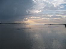
The Sharda Barrage, also known as the Lower Sharda Barrage, is nearly 28 km from Lakhimpur city in Uttar Pradesh, India.
Contents
Map of Sharda Barrage, Mundi, Uttar Pradesh
Construction
The Lower Sharda Barrage is constructed on the Sharda River, about 163.5 km downstream of the Upper Sharda Barrage.
This project is part of the Sharda Sahayak Pariyojana (SSP) and primarily depends on water diverted from the Karnali (Ghaghra) at Girjapur through the Sharda Sahayak link canal of 28.4 km length for over eight months in the year during the lean season; but it indents on Sharda supplies during the monsoon between July and October when the Karnali carries a lot of silt.
Economy
The SSP aims at irrigating culturable command area (CCA) of 16,770 km2 with 70 per cent irrigation intensity. The 258.80 km long feeder channel of SSP takes off from the right bank of Sharda Barrage with discharge of 650 m3/s. Supplies are then fed into the different branches of the Sharda canal system, namely, the Dariyabad branch, the Barabanki branch, the Haidergarh branch, the Rae Bareli branch and the Purva branch.
SSP provides protective canal irrigation for cultivable area of 2 m ha to lakhs of farmers in 150 development blocks of 16 districts in eastern Uttar Pradesh. The project was commissioned in 1974, and completed in 2000 with an estimated cost of Rs. 1,300 crore.