
Chinese 深圳河 Romanization cim zun ho Jyutping sam zan ho Countries China, Hong Kong | Hanyu Pinyin IPA [sɐ́m tsɐ̄n hɔ̏ː] Basin area 312.5 km² | |
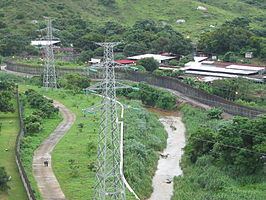 | ||
Sham Chun River (also called Shenzhen River in Shenzhen) serves as the natural border between Hong Kong and Mainland China, together with the Sha Tau Kok River and Deep Bay.
Map of Sham Chun River
It formed part of the limit of the lease of the New Territories in 1898 in the Convention for the Extension of Hong Kong Territory (also Second Convention of Peking).
It separates North District, Hong Kong and the city of Shenzhen, Guangdong. Its source is at Wutong Mountain, Shenzhen. Its tributaries includes Ping Yuen River, Shek Sheung River, Sheung Yue River, Ng Tung River, Buji River and Tan Shan River. The Shenzhen Reservoir also flows into the river when it is full.
The river flows into Deep Bay (also known as Hau Hoi Wan and Shenzhen Bay). The Mai Po Marshes is at its estuary.
Efforts have been made to alleviate flooding and pollution problems through river training, which produced the Lok Ma Chau Loop.