
Area 40.46 km² | ||
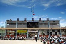 | ||
Shalu District (Chinese: 沙鹿區; pinyin: Shālù Qū) is a suburban district in central Taichung City, Taiwan.
Contents
- Map of Shalu District Taichung City Taiwan 433
- History
- Administrative divisions
- Native products
- Education
- Airport
- Railway stations
- Notable natives
- References
Map of Shalu District, Taichung City, Taiwan 433
History
Originally a settlement of the Papora people, of various Chinese names (沙轆/沙轆社/社口番地), perhaps referring to sand blown by the wind. During the Kingdom of Tungning (1662-1683), the Taiwanese Plains Aborigines were driven away or sinicized, and the area became a Han settlement. In 1731 during Qing rule, Tamsui Subprefecture (淡水廳) extended from the Tai-kah River northward up to Kelang (雞籠; Keelung).
In 1920, during Japanese rule, the written name (Chinese: 沙轆; Pe̍h-ōe-jī: Soa-la̍k; literally: "sand wheel") was changed (沙鹿; Soa-lo̍k; "sand deer"); in Japanese, both names are read as Sharoku. Administratively, Sharoku Village (Japanese: 沙鹿庄) was under Taikō District (大甲郡), Taichū Prefecture. In Taiwanese Hokkien, the old name (Soa-la̍k) is still used.
In 1945 the village was changed to an township, and was upgraded to a district in 2010.
Administrative divisions
Juren, Luoquan, Shalu, Meiren, Xingren, Xingan, Doudi, Lufeng, Luliao, Zhulin, Lifen, Fuxing, Beishi, Jinjiang, Liulu, Nanshi, Puzi, Sanlu, Gongming, Qingquan and Xishi Village.