
Country India Administrative division Fatahan Division Major highways N.H 531 Area 4,000 km² Lok sabha constituency Gopalganj | State India Headquarters [[Gopalganj]] Average annual precipitation 44.5 mm Literacy 75% | |
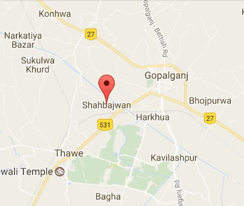 | ||
Shahbajwan is a village in Gopalganj, Bihar, situated near Turkahan near Thawe road. It is a small village.
Contents
Map of Shahbajwan, Bihar 841440
History
People believed that long ago it is a part of village Fathan but later divided due to a river came between them. This river later meet to Gandhak river. Jobs are also available there. Ancient history is still a mystery. After divided by the river, it is believed that it only a part of fatahan. In 1996 it is officially declared as a village. Mohammad Abdullah Shaikh
Location
Shahbazwan is located near the Turkahan – Thawe road. It is in back side of Government School named M.M.M Urdu High School.
References
Shahbazwan Wikipedia(Text) CC BY-SA