
Area 209.3 km² Local time Monday 12:04 AM | Phone number 0241-57-2114 Population 1,332 (Sep 2014) | |
 | ||
Weather -2°C, Wind S at 6 km/h, 90% Humidity Points of interest Karamushikogei Museum, Mt. Hakase, Shintorii Pass, Funehana Pass | ||
Shōwa (昭和村, Shōwa-mura) is a village located in Ōnuma District, Fukushima Prefecture, in northern Honshū, Japan. As of September 2014, the village had an estimated population of 1,332 and a population density of 6.36 persons per km². The total area was 209.34 km².
Contents
- Map of Showa Onuma District Fukushima Prefecture Japan
- Geography
- Neighboring municipalities
- History
- Education
- Highway
- Local attractions
- References
Map of Showa, Onuma District, Fukushima Prefecture, Japan
Geography
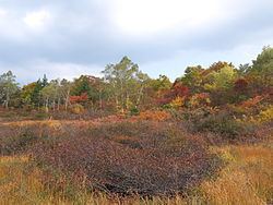
Shōwa is located in the western portion of the Aizu region of Fukushima Prefecture. The climate is like many other parts of northern Japan, with cold winters and snowfall averaging 2 meters.
Neighboring municipalities
History
The area of present-day Shōwa was part of ancient Mutsu Province and formed part of the holdings of Aizu Domain during the Edo period. After the Meiji Restoration, it was organized as part of Ōnuma District.
Modern Shōwa village was founded on November 23, 1927 through a merger of the villages of Nojiri and Oashi. It was raised to town status on April 1, 1961.