
Source Loch Lomond Mouth elevation 0 | Bridges Dollarton Bridge | |
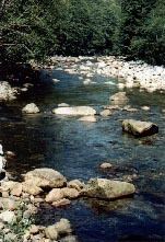 | ||
The Seymour River is a river in North Vancouver, British Columbia which is notable for being several degrees warmer than other streams and lakes in the area. This is due to it being fed from a large reservoir backed up behind a dam from which a constant flow of water is released. The upper portion of the river and the reservoir are part of the Seymour watershed, controlled by Metro Vancouver.
The Seymour River has been the main water supply for North Vancouver since 1907. The first intake was built in 1907 and the first Seymour Dam was constructed in 1927. The present day Seymour Falls Dam was constructed 1961. Up to 40,000 fed coho fry are released above the dam each year by the Seymour Salmonid Society.
The hydrometric data for this river can be found under the Water Survey of Canada's website as the Seymour River below Orchid Creek (station 08GA077). See: http://www.wateroffice.ec.gc.ca/graph/graph_e.html?stn=08GA077.