
OS grid reference TR0340 Region South East Sovereign state United Kingdom Local time Thursday 6:30 PM District Borough of Ashford UK parliament constituency Ashford | Civil parish Sevington Country England Area 76 ha Shire county Kent Dialling code 01233 | |
 | ||
Population 310 (Civil Parish 2011) Weather 19°C, Wind SE at 11 km/h, 52% Humidity | ||
Sevington is a contiguous suburb of Ashford, Kent in England. It is mostly business/market use and was once a very small rural village so keeps a community civil parish council for its few suburban streets.
Contents
Map of Sevington, Ashford, UK
Geography and economy
Much of Sevington's small tract of land is covered by Ashford business park areas which are connected with Ashford by post town status and by its road network - linking them closely with Ashford.
At the start of the 21st century many changes took place in Sevington due to the building of the Orbital Business Park including the Ashford livestock market.
The village/suburb of Willesborough bounds Sevington (along its long north-west border), the new Finberry neighbourhood is to the south in Mersham but with its own amenities. High Speed 1, adjoining the ordinary railway, passes through the parish.
History
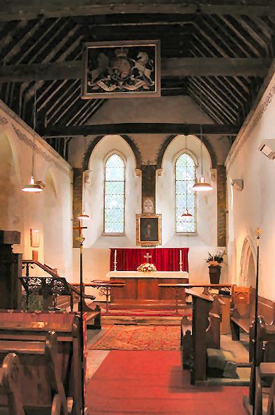
The geographically small village is recorded in the Domesday Book and St Mary's Church, a Norman church was altered about 1200 and in the 14th century, it is cut off from the village by the building of the Southern Orbital road. It had a population of about 113 in 1872.