
Founded October 17, 1828 Area 1,505 km² | Named for Ambrose Hundley Sevier Website seviercountyar.com Population 17,366 (2013) | |
 | ||
Cities University Cossatot Community College Rivers Little River, Saline River, Blacks Branch, Buck Creek Points of interest DeQueen Lake, De Queen Parks & Recreation, Herman Dierks Memorial, Dierks Lake | ||
Sevier County is a county located in the U.S. state of Arkansas. As of the 2010 census, the population was 17,058. The county seat is De Queen. Sevier County is Arkansas's sixteenth county, formed on October 17, 1828, and named for Ambrose Sevier, U.S. Senator from Arkansas. It is an alcohol prohibition or dry county.
Contents
- Map of Sevier County AR USA
- History
- Geography
- Major highways
- Adjacent counties
- National protected area
- Demographics
- Cities
- Towns
- Townships
- References
Map of Sevier County, AR, USA
History
Sevier County was organized on October 17, 1828 under legislative authority. It was formed from Hempstead and Miller Counties. Five days later on October 22, 1818, the legislature expanded the county's border, incorporating more land south of the Red River. Hempstead, Miller and Crawford Counties as well as the Choctaw Nation in Indian Territory bound Sevier County. The establishment of Sevier County became effective on November 1, 1828.
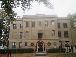
The county seat has undergone several changes since Sevier County was organized. The first county seat was Paraclifta. In 1871, the Lockes donated 120 acres (0.49 km2) of land. As a result, the county seat was moved to Lockesburg. In 1905, the county seat was again moved to De Queen. Sevier County is known as “The Land of Lakes”, “The Land of Fruits and Flowers” and “The Home of Friendly People”. The county has five lakes within a 35-mile (56 km) radius, five rivers and mountain streams and forests.
Geography
According to the U.S. Census Bureau, the county has a total area of 581 square miles (1,500 km2), of which 565 square miles (1,460 km2) is land and 16 square miles (41 km2) (2.8%) is water.
Major highways
Adjacent counties
National protected area
Demographics
As of the 2000 United States Census, there were 15,757 people, 5,708 households, and 4,223 families residing in the county. The population density was 28 people per square mile (11/km²). There were 6,434 housing units at an average density of 11 per square mile (4/km²). The racial makeup of the county was 79.61% White, 4.94% Black or African American, 1.82% Native American, 0.13% Asian, 0.06% Pacific Islander, 11.84% from other races, and 1.61% from two or more races. 19.72% of the population were Hispanic or Latino of any race. 17.32% reported speaking Spanish at home [1].
There were 5,708 households out of which 36.40% had children under the age of 18 living with them, 59.30% were married couples living together, 10.00% had a female householder with no husband present, and 26.00% were non-families. 22.80% of all households were made up of individuals and 11.00% had someone living alone who was 65 years of age or older. The average household size was 2.73 and the average family size was 3.19.
In the county, the population was spread out with 28.20% under the age of 18, 9.50% from 18 to 24, 27.70% from 25 to 44, 21.30% from 45 to 64, and 13.20% who were 65 years of age or older. The median age was 34 years. For every 100 females there were 99.10 males. For every 100 females age 18 and over, there were 97.00 males.
The median income for a household in the county was $30,144, and the median income for a family was $34,560. Males had a median income of $25,709 versus $17,666 for females. The per capita income for the county was $14,122. About 14.40% of families and 19.20% of the population were below the poverty line, including 26.90% of those under age 18 and 14.20% of those age 65 or over.
Cities
Towns
Townships
Townships in Arkansas are the divisions of a county. Each township includes unincorporated areas; some may have incorporated cities or towns within part of their boundaries. Arkansas townships have limited purposes in modern times. However, the United States Census does list Arkansas population based on townships (sometimes referred to as "county subdivisions" or "minor civil divisions"). Townships are also of value for historical purposes in terms of genealogical research. Each town or city is within one or more townships in an Arkansas county based on census maps and publications. The townships of Sevier County are listed below; listed in parentheses are the cities, towns, and/or census-designated places that are fully or partially inside the township.
Source: