
Urban-type settlements 4 Urban-type settlements 4 | Federal subject Republic of Buryatia Selsoviets 6 Area 53,991 km² | |
 | ||
Administrative center | ||
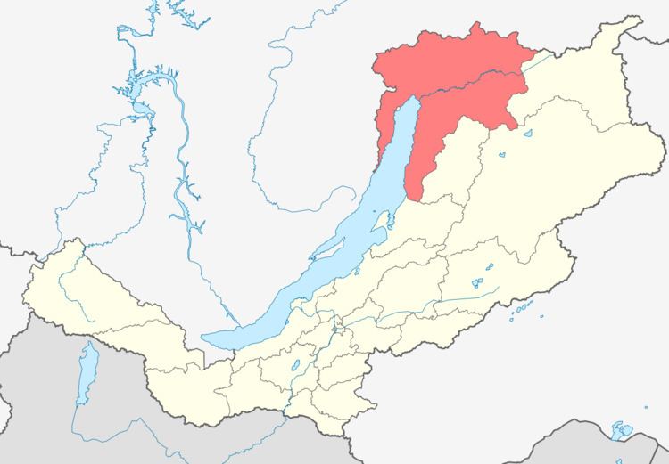
Severo-Baykalsky District (Russian: Се́веро-Байка́льский райо́н; Buryat: Хойто-Байгалай аймаг) is an administrative and municipal district (raion), one of the twenty-one in the Republic of Buryatia, Russia. It is located in the northeast of the republic. The area of the district is 54,000 square kilometers (21,000 sq mi). Its administrative center is the urban locality (an urban-type settlement) of Nizhneangarsk. As of the 2010 Census, the total population of the district was 14,035, with the population of Nizhneangarsk accounting for 35.8% of that number.
Contents
- Map of Severobaykalskiy r n Buryatia Russia
- History
- Administrative and municipal status
- Nature
- References
Map of Severobaykalskiy r-n, Buryatia, Russia
History
The district was established on September 10, 1925.
Administrative and municipal status
Within the framework of administrative divisions, Severo-Baykalsky District is one of the twenty-one in the Republic of Buryatia. It is divided into four urban-type settlements (administrative divisions with the administrative centers, correspondingly, in the urban-type settlements (inhabited localities) of Kichera, Nizhneangarsk, Novy Uoyan, and Yanchukan) and six selsoviets, all of which comprise eight rural localities. As a municipal division, the district is incorporated as Severo-Baykalsky Municipal District. The four urban-type settlements are incorporated as four urban settlements, and the six selsoviets are incorporated as six rural settlements within the municipal district. The urban-type settlement of Nizhneangarsk serves as the administrative center of both the administrative and municipal district.
Nature
The Barguzin Nature Reserve is located on the territory of the district.