
Country Switzerland Postal code 6713, 6714, 6721 | Area 96.92 km² Sfos number 5050 | |
 | ||
Website http://www.serravalle.ch SFSO statistics | ||
Serravalle is a municipality in the district of Blenio in the canton of Ticino in Switzerland. It was formed on 1 April 2012 by the merger of the former municipalities of Malvaglia, Semione and Ludiano.
Contents
- Map of 6713 Serravalle Switzerland
- Ludiano
- Malvaglia
- Geography
- Historic Population
- Heritage sites of national significance
- References
Map of 6713 Serravalle, Switzerland
Ludiano
In 1926 a grave was discovered which contained Iron Age grave offerings. The modern municipality of Ludiano is first mentioned in 1211 as Luguilano. It was mentioned as a local center for surrounding farmhouses and villages in 1351.
The parish church of S. Secondo is first mentioned in 1293. It was rebuilt in 1779-82, though the older romanesque clock tower was retained.
In the past, the main sources of income were crops, livestock and vineyards. This income was supplemented by money sent back to the village by emigrants to other European countries. After the emigration-related decline in the mid-19th century, the number of inhabitants has increased in the last decades of the 20th century and has led to numerous new homes. In 2000 about half the jobs in the village were in manufacturing and the services sector accounted for about a fifth of the jobs. Two thirds of the working population earned their livelihood outside the community.
Malvaglia
Malvaglia is first mentioned in 1205 as de Malvallia. In German it used to be known as Manglia. Malvaglia's development and history is closely tied to the development and history of the Blenio valley. In the settlement of Rongier, an ancient town on the Lukmanier road, a Roman coin hoard was found. The settlement is also home to the Casa Baggio. Casa Baggio was built in the 16th century and expanded in the 17th. It was probably the ruling seat of the bailiff. The building is now listed as a historic building. Above the village is also the remains of Casa dei pagani, a cave castle from the 11th-13th Centuries.
The original, parish church was dedicated to St. Benedict and first mentioned in 1207. The current building, with St. Martin as the patron saint is from 1602–03, but the bell tower is from the 13th Century.
The local economy was dominated by agriculture, animal husbandry, vineyards. The emigration in until the 19th century to Italy and in the 19th and 20th centuries to France, England, and America, led to a sharp population decline. Between 1933 and 1959, the first cable car in the Canton was in operation between Malvaglia and Ponterio in the Malvaglia Valley. In 1995 a new line was inaugurated on Mount Dagro. In the 1940s for the construction of the dam, a road was built into the Malvaglia Valley. The ring road around the village open in 1976. In 2000 about one-third and one-half of the workers were employed in manufacturing and the services sectors, respectively. More than half of employed persons worked outside of the municipality.
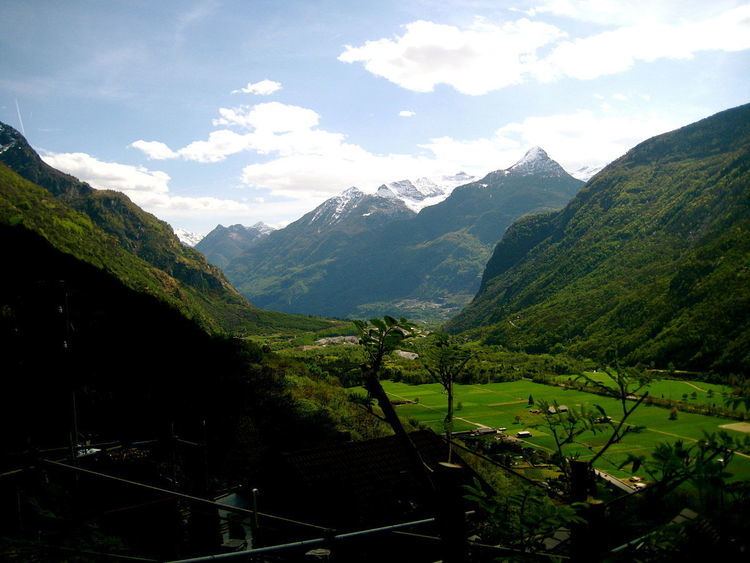
Geography
Serravalle has an area of 96.92 km2 (37.42 sq mi). Of this area, 3.37 km2 (1.30 sq mi) or 3.5% is used for agricultural purposes, while 44.08 km2 (17.02 sq mi) or 45.5% is forested. Of the rest of the land, 1.63 km2 (0.63 sq mi) or 1.7% is settled (buildings or roads), 1.24 km2 (0.48 sq mi) or 1.3% is either rivers or lakes and 37.38 km2 (14.43 sq mi) or 38.6% is unproductive land.
Of the built up area, housing and buildings made up 1.1% and transportation infrastructure made up 0.4%. Out of the forested land, 36.1% of the total land area is heavily forested and 1.9% is covered with orchards or small clusters of trees. Of the agricultural land, 1.8% is used for growing crops and 1.1% is used for alpine pastures. Of the water in the municipality, 0.2% is in lakes and 1.1% is in rivers and streams. Of the unproductive areas, 13.0% is unproductive vegetation and 25.5% is too rocky for vegetation.
Historic Population
The historical population is given in the following chart:
Heritage sites of national significance
The Casa dei pagani (a cave castle) and the parish church of S. Martino with its ossuary and churchyard in Malvaglia and the Parish Church of S. Maria Assunta with Ossuary, the Oratory of S. Maria Bambina a Navone and the Rovine del castello di Serravalle in Semione are listed as Swiss heritage site of national significance. The villages of Rongie/Orino, Semione, Navone and the Val Malvaglia region are all listed on the Inventory of Swiss Heritage Sites