
Area 1,256 km² | Time zone CET (UTC+1) Population 55,835 (2009) | |
 | ||
Municipalities ListAlgatocín, Alpandeire, Arriate, Atajate, Benadalid, Benalauría, Benaoján, Benarrabá, Cartajima, Cortes de la Frontera, Faraján, Gaucín, Genalguacil, Igualeja, Jimera de Líbar, Jubrique, Júzcar, Montejaque, Parauta, Pujerra, Ronda Points of interest Sierra de las Nieves, Zahara‑El Gastor Reservoir, Sierra de Grazalema Natural P, Puente Nuevo, Museo del Bandolero‑Ronda Destinations Ronda, Gaucín, Montejaque, Arriate, Cortes de la Frontera | ||
Genalguacil hd in serran a de ronda costa del sol and m laga andalusia spain
The Serranía de Ronda is a comarca in the western part of province of Málaga, Andalusia, Spain. As is currently (as of 2009) the norm in Andalusia, it has no formal status. The new 2007 Statute of Autonomy of Andalusia, unlike its 1981 predecessor, mentions comarcas in Article 97 of Title III, which defines the significance of comarcas and establishes a basis for formal recognition in future legislation, but no such legislation has yet been enacted.
Contents
- Genalguacil hd in serran a de ronda costa del sol and m laga andalusia spain
- Map of SerranC3ADa de Ronda MC3A1laga Spain
- Gauc n hd in serran a de ronda costa del sol and m laga andalusia spain
- Geography
- Municipalities
- Statistics
- References
Map of Serran%C3%ADa de Ronda, M%C3%A1laga, Spain
Gauc n hd in serran a de ronda costa del sol and m laga andalusia spain
Geography
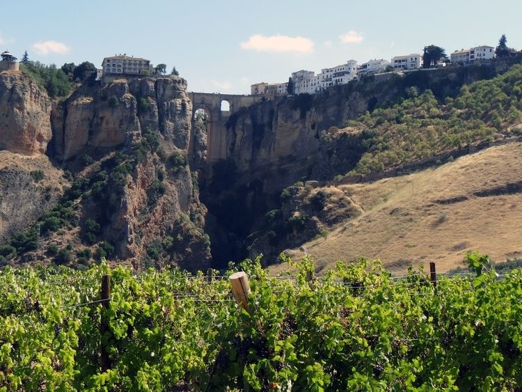
it is an area of outstanding natural beauty and great geographical diversity. Popular with walkers, birdwatchers, climbers and potholers. it contains both the Sierra de Grazalema - reputedly one of the wettest regions in Spain - and the Sierra de las Nieves. The central town of Ronda is the administrative headquarters, perched on a high plateau, with numerous small, "pueblos blancos" or white villages dotted around the surrounding countryside.
There are limestone escarpments, cork forests and fields of wheat and sunflowers. Numerous small rivers cross the landscape. The climate is generally dry and hot in summer, with mild spring and autumn seasons. Winters can be very cold, particularly at night, and snow is not uncommon at the higher altitudes. Cloudless days in winter can be warm and bright and the light is considered to be good for photography and painting.
Ornithologists value this area as a major migration route and some rare species can be seen.
Municipalities
According to the Provincial Deputation of Málaga, the comarca consists of the following municipalities:
The Andalusian Autonomous Government adds the municipalities of Cuevas del Becerro and El Burgo to this list.
Statistics
Naturally, the basic statistics are slightly different, depending on whether or not Cuevas del Becerro and El Burgo are counted as part of the comarca.