
Established 1971 | Area 1,040 km² | |
 | ||
Similar Serra do Mar, Serra dos Órgãos National, Itatiaia National Park, Serra do Mar State Park, Serra da Capivara National | ||
Serra da Bocaina National Park is a national park of Brazil. It is located at the border between the states of Rio de Janeiro and São Paulo in southeastern Brazil.
Contents
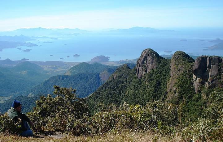
Map of Serra da Bocaina, Paraty - State of Rio de Janeiro, Brazil
Location
Created by Federal Decree in 1971 and comprises an area of approximately 104,000 hectares (260,000 acres) and a significant biodiversity. The park headquarters is located in São José do Barreiro, the State of São Paulo. It is administered by the Chico Mendes Institute for Biodiversity Conservation (ICMBio). It is estimated that 60% of the vegetation is composed of native Atlantic Forest, and the rest is forest regenerated (secondary) for over 30 years.
The highest point is Pico do Tira o Chapéu, which reaches 2,088 metres (6,850 ft) above sea level, one of the highest points of the State of São Paulo.
The park is part of the 221,754 hectares (547,970 acres) Bocaina Mosaic, created in 2006.
Biota
Among the species of flora are pines, cedars, trumpet trees, palm trees and bromeliads. Among the fauna of the park are cats, sloths, deer, monkeys, snakes and birds.
A number of amphibians are only known from the park and its buffer area: Brachycephalus vertebralis, Ischnocnema pusilla, Bokermannohyla ahenea, Bokermannohyla clepsydra, Scinax ariadne, Megaelosia bocainensis, Physalaemus barrioi, and Paratelmatobius gaigeae.