
Local time Thursday 4:22 AM | ||
 | ||
Weather -2°C, Wind W at 3 km/h, 64% Humidity | ||
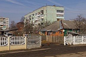
Serebryanye Prudy (Russian: Сере́бряные Пруды́, lit. Silver Ponds) is an urban locality (a work settlement) and the administrative center of Serebryano-Prudsky District of Moscow Oblast, Russia, located on the Osyotr River. Among the district centers of Moscow Oblast, it is the southernmost, and the farthest from Moscow. Population: 9,705 (2010 Census); 8,969 (2002 Census); 8,977 (1989 Census).
Contents
- Map of Serebryanye Prudy Moskovsky Russia 142970
- Eastern road to serebryanye prudy time lapse photography
- References
Map of Serebryanye Prudy, Moskovsky, Russia, 142970
Serebryanye Prudy stands on the M6 highway (Moscow–Astrakhan) and the Moscow–Volgograd railway.
Serebryanye Prudy was first mentioned in a chronicle in 1571. Under the Russian Empire, it was a village of Venyovsky Uyezd of Tula Governorate. It became a district center in 1924. In 1929, Serebryanye Prudy was transferred to the Central Industrial Oblast which in September 1937 was split, with the village finding itself again in Tula Oblast, only to be included into Moscow Oblast in 1942. It was granted urban-type settlement status in 1961.
Postal code: 142970. Dialing code: +7 49667.