
Headquarters Senapati Website Official website Literacy 74.1% Lok sabha constituencies Karong, Tadubi | Vehicle registration MN03 Area 3,269 km² Tehsil 1. | |
 | ||
Major highways National Highway 39, AH2, Asian Highway 1 Points of interest Shilheipung, Dzü‑ko Valley, Koubru Peak | ||
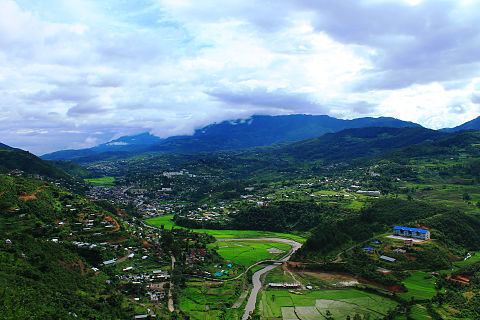
Very hilly but beautiful view of senapati district manipur
Senapati (Pron:/ˌseɪnəˈpʌti/) is a district of Manipur state in India.
Contents
- Very hilly but beautiful view of senapati district manipur
- Map of Senapati Manipur
- Open air clothes market in senapati district manipur
- Geography
- Hydrology
- Administrative Divisions
- Agriculture
- Demographics
- Languages
- Roads
- Festivals
- Places of interest
- References
Map of Senapati, Manipur
Open air clothes market in senapati district manipur
Geography
Senapati District is located between 93.29° and 94.15° East Longitude and 24.37° and 25.37° North Latitude and is in the northern part of Manipur state. The District is bounded on the south by Kangpokpi District, on the east by Ukhrul District, on the west by Tamenglong District and on the north by Phek district of Nagaland Nagaland state. The district lies at an altitude between 1061 meter to 1788 meters above sea level.
Hydrology
The district is under humid subtropical climate. The soil is moderately fertile with clay loam soil with little patches of clay and loam. The temperature ranges from a minimum of 3.4 °C (38.1 °F) to a maximum of 34.1 °C (93.4 °F). The annual rainfall ranges from 670 to 1,450 mm (26.4 to 57.1 in). There are about 110 watersheds each of geographical size ranging from 2,000 to 3,000 hectares (4,900 to 7,400 acres), which are drained finally at about 5 major rivers/streams of different aspects and sources as indicated below:
Administrative Divisions
Senapati is the fourth largest district of Manipur within the union of India. Senapati district is under the charge of a Deputy Commissioner cum District Magistrate assisted by a number of other officials including District Supply Officer (FCS), one Assistant Engineer (Dev), one Assistant Election Officer, one Assistant Project Officer and one office Superintendent. The Deputy Commissioner functions as the Additional Development Commissioner, and he is also the ex officio Chairman of the District Rural Development Agency, Senapati.
The district is divided into five subdivisions:
Agriculture
66.43% of the land area is covered by forest while the rest 20% are utilized for cultivation. Rice, Maize, Potato, Cabbage and cereals are the major produces of the district. Agriculture is the main occupation of the people and terrace cultivation is generally practice by the people.
Demographics
According to the 2011 census Senapati district has a population of 479148 , roughly equal to the nation of Belize. This gives it a ranking of 565th in India (out of a total of 640). The district has a population density of 109 inhabitants per square kilometre (280/sq mi) . Its population growth rate over the decade 2001-2011 was 25.16%. Senapati has a sex ratio of 939 females for every 1000 males, and a literacy rate of 75%.
Mao Naga, Maram, Thangal, Poumai, Thangal, Zemai, Liangmai, Rongmei(Kabui), Tangkhul, Meetei, Thadou, Nepalese, Vaiphei, Chothe, Chiru, Maring are the major inhabitants of this district.
Languages
Languages spoken include the following.
Roads
92 km of NH 2 passes through the District from the south end to the north end. Imphal-Tamenglong via Kangpokpi road, Maram-Paren road, Tadubi-Tolloi-Ukhrul road, Maram-Ngari-Kachai road, Karong-Purul-Liyai road, Senapati-Khongdei-Phaibung road are other important roads in the district.
Festivals
District is settled by different communities so there are different varieties of festival are celebrated. some of the important festivals are as follows:
Chaga Ngee
Celebrated by liangmai tribe on 30 Oct. It is a festival of sanctification or purification. the biggest and the most important festival of liangmai
Places of interest
National Highway 39 Passes through here.