
District Senafe District Climate BSk | Region Debub Elevation 2,446 m (8,025 ft) Local time Wednesday 3:15 PM | |
 | ||
Weather 21°C, Wind E at 13 km/h, 40% Humidity Neighborhoods Walaka, Senafe, Kambo, Piasa, Senafe, Shuk Hakir | ||
Eritrea senafe town welcomes the deported citizens august 1998 p1
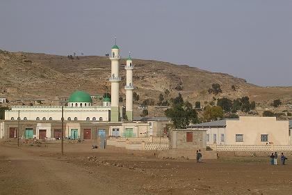
Senafe (Tigrinya: ሰንዓፈ? [sɐnʕafɐ]) is a market town in southern Eritrea, on the edge of the Eritrean highlands. The surrounding area is inhabited by the Saho people and the Tigrinya people.
Contents
- Eritrea senafe town welcomes the deported citizens august 1998 p1
- Map of Senafe Eritrea
- Eritrean music nafiqe adey senafe
- History
- Climate
- References
Map of Senafe, Eritrea
Senafe is known for the ruins of Metera (also known as Balaw Kalaw), the monolithic church of Enda-Tradqan and for the local stone outcrops.
Eritrean music nafiqe adey senafe
History
The original name for Saanafè was Hakir. Local tradition states that the name was changed by a man named Abdullah from Sana'a in Yemen; he settled in the Awdie district of Hakir, and upon marrying a local woman he was quoted as saying "Sana-fen" which means in Arabic "where is Sana'a" he was relating to his hometown; thus the town was named Sanafe; his descendants form a tribe and are also known as Saanafè.
An early record of Sanafe is on the Egyptus Novello map, published in 1454. This map shows Sanafe at the edge of Tigray, connected to two routes, one leading west to Axum, the other south to Lake Ashangi. According to James Bruce, the party of Jesuits which included the Catholic patriarch Afonso Mendes and Fr. Jerónimo Lobo, passed through Senafe in 1625, having entered the Horn of Africa by way of Beilul and having crossed the Danikil Desert.
Senafe is mentioned in an 1794-5 land grant (1787 E.C.) from the Ethiopian Emperor Tekle Giyorgis to Ras Wolde Selassie.
During his reconnaissance work for the British expedition against Emperor Tewodros, Clements Markham visited Senafe, finding it situated "at the foot of the grand mass of sandstone rock about half a mile north-west of the camp, called Amba-Adana." The town itself consisted "of about a dozen houses built of rough stones and mud, with flat roofs branches being placed in rows across the beams, and covered with mud. Broken jars plastered into the roof, serve as chimneys." He gave the population as 240 people. During Italian rule, the town grew notably: when A.J. Shepherd visited Senafe a few years after Markham, he described it as having only "some twelve or fourteen bee-hive shaped buildings ... and as many diminutive barns"; in 1891 Alamanni estimated its population as 1,500, and the Italian Guido of 1938 stated the population had increased to 2,000. The modern town suffered extensive destruction during the Eritrean War of Independence and the Eritrean-Ethiopian War, although people are gradually returning from its surrounding refugee camps.
Climate
The prevailing climate in Senafe is known as a local steppe climate.