 | ||
Similar Semiahmoo Resort, Crescent Beach - British Co, Peace Arch Park, Ocean Park - Surrey, Peace Arch | ||
Whale watching white rock surrey bc semiahmoo bay molly s point
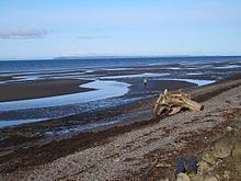
Semiahmoo Bay (/ˌsɛmiˈɑːmoʊ/ SEM-ee-AH-moh) is the southeastern section of Boundary Bay on the Pacific coast of North America. The bay is named for the Semiahmoo First Nation, who originally occupied the area.
Contents
- Whale watching white rock surrey bc semiahmoo bay molly s point
- Map of Semiahmoo Bay
- Powered paraglider flights ppg flying in 1080p hd at 60fps off semiahmoo bay on the pacific ocean
- References
Map of Semiahmoo Bay
From the north to south, the following communities and places are located on its shore:
Blaine's Drayton Harbor opens into Semiahmoo Bay; the harbor is separated from the main body of the bay by Semiahmoo Spit. The Semiahmoo Resort is located on the spit.
The Washington State Department of Ecology classified the marine waters within Semiahmoo Bay, outside of Drayton Harbor, as extraordinary quality waters for (1) salmonid and other fish migration, rearing, and spawning; (2) clam, oyster, and mussel rearing and spawning; and (3) crustaceans and other shellfish (crabs, shrimp, crayfish, and scallops) rearing and spawning.
The Campbell River flows into Semiahmoo Bay on the Canadian side; California Creek and Dakota Creek flow into Drayton Harbor on the US side.
