
Status Operational Type of dam Buttress Height 106 m Construction began 1956 | Opening date 1962 Impounds Sefīd-Rūd Opened 1962 Impound Sefīd-Rūd | |
 | ||
Similar Tarik Dam, Latyan Dam, Amir Kabir Dam, Dez Dam, Karkheh Dam | ||
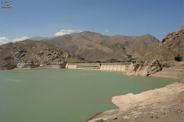
Sefidrud Dam (originally named Shahbanu Farah Dam and also known as the Manjil Dam) is a buttress dam on the Sefīd-Rūd in the Alborz mountain range, located near Manjil in Gilan Province, northern Iran.
Map of Sefidrud Dam, Gilan Province, Iran
It was constructed to store water for irrigation and produce hydroelectric power. The power station has an installed capacity of 87 MW. It is 106 m (348 ft) tall and forms a reservoir with a capacity of 1.82 km3 (1,475,498 acre·ft). Its structure contains 26 monoliths.
The Tarik Dam is located 35 km (22 mi) downstream and diverts releases from the Sefidrud Dam for irrigation.
The extremely destructive 1990 Manjil–Rudbar earthquake occurred near the dam and caused portions of its concrete to crack. Repairs and mitigation efforts were undertaken in 1991.