
Country New Zealand Postcode 7210 Local time Sunday 11:59 PM | Region Marlborough Population 507 (2013) | |
 | ||
Weather 16°C, Wind NW at 11 km/h, 86% Humidity | ||
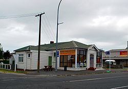
Seddon is a small town in Marlborough, New Zealand. It is located 25 kilometres (16 mi) south of Blenheim, close to the mouths of the Awatere and Blind Rivers and the Lake Grassmere salt works. At the 2013 Census, the town had a population of 507 people.
Contents
Map of Seddon, New Zealand
Salt and lime are major local industries, and the Awatere Valley is a developing wine region.
The town was named for a former Prime Minister of New Zealand, Richard Seddon.
Earthquakes
Seddon has been close to the epicentres of several significant earthquakes.
On the morning of 16 October 1848, Marlborough was struck by a damaging earthquake later estimated to be between magnitude 7.4 and 7.7. The epicentre of this earthquake was 45 km southeast of Seddon.
On 23 April 1966, a magnitude 5.8 earthquake with an epicenter in Cook Strait, 40 km east of Seddon was most strongly felt in the town, damaging the chimney on almost every house in town.
In July and August 2013 Seddon was closest settlement to the epicentres of a doublet earthquake event. First, in late July, a series of sizeable earthquakes struck the region over a period of a few days being felt strongly in Blenheim, Wellington and the rest of Central New Zealand, the strongest being a magnitude 6.5 and having its epicentre in Cook Strait. Then on 16 August 2013 a magnitude 6.6 earthquake with its epicentre under Lake Grassmere struck about 2:30 PM and was followed by a series of aftershocks over the next few hours, one of which was above magnitude 6 and several others above magnitude 5. This came just a few years after devastating earthquakes affected Christchurch, 285 km away.
Transport
State Highway 1 passes through Seddon on its route between Blenheim and Christchurch.
The Marlborough section of the Main North Line railway reached Seddon from Blenheim in October 1902. This also saw the construction of a combined road-rail bridge over the Awatere River north of the town, with the single-lane road below the rail. The bridge remained in service for road traffic until October 2007, when a new two-lane road bridge opened. Seddon was the southern terminus of the railway until the line was extended to Ward in April 1911; the full line through to Christchurch didn't open until December 1945. Today, Seddon is served by the Coastal Pacific train, which runs once daily each way during the summer months.
A train derailment at Blind River, south of Seddon, on 25 February 1948, killed six people and injured 40 others.
Education
Seddon School is the sole school in the town. It is a coeducational full primary (year 1–8) school with a roll of approximately 128. The nearest state secondary schools are Marlborough Boys' College and Marlborough Girls' College in Blenheim.