
Local time Sunday 1:57 AM | ||
 | ||
Weather 4°C, Wind N at 8 km/h, 71% Humidity | ||
Po ova ka na daniela ms havran sebuz n r hunting
Sebuzín is a village in the Ústí nad Labem Region, Czech Republic. It is the part of the urban perimeter of Ústí nad Labem - Střekov. It is located on the right bank of the River Labe, in the Czech Central protected landscape area České Středohoří, on Tlučeň creek 143 m (469 ft) above sea level. The hills Krkavčí skála, Varhošť, Trabice and Deblík are in the surrounding area.
Contents
- Po ova ka na daniela ms havran sebuz n r hunting
- Map of SebuzC3ADn 403 02 C39AstC3AD nad Labem StC599ekov Czechia
- Sebuz n 9 011
- History
- Historic sites
- References
Map of Sebuz%C3%ADn, 403 02 %C3%9Ast%C3%AD nad Labem-St%C5%99ekov, Czechia
Sebuz n 9 011
History
The first mention of Sebuzín was in 1251. The name is derived from Slavonic name Chcebud. Sebuzín was a liege village, which was despoiled during the 30 Years War. The first mention of the school in the village was in 1774. Most of houses where destroyed by a big fire in 1827. In 1855, a cholera epidemic spread. The main livelihood of the inhabitants is in growing fruit trees (cherries, apricots, apples, peaches, pears) and exporting it to Germany down the River Labe. Sebuzín was part of the town of Litoměřice until 1960.
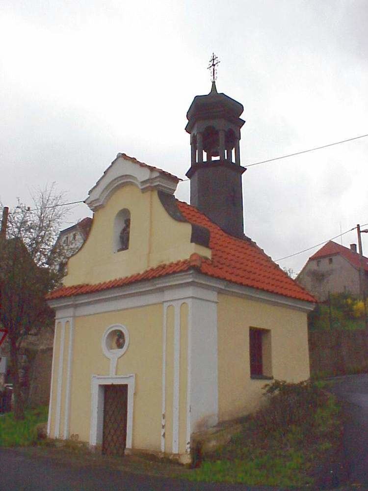
Historic sites
The Baroque chapel of St. Vincent Ferrer is situated upon the village square in the centre of the village. It is a registered national landmark protected by the state. It was built in 1745. There is a sculpture in the niche and an iron bell in the pinnacle.