Mission type Oceanography COSPAR ID 1978-064A Mission duration 105 days achieved Inclination 108° Period 1.7 hours Bus RM-81 Agena | SATCAT no. 10967 Launch date 28 June 1978 Inclination 108° Last contact 10 October 1978 | |
 | ||
Manufacturer LockheedBall AerospaceJPL Similar Geosat, Radarsat‑1, QuikSCAT, JERS‑1, Envisat | ||
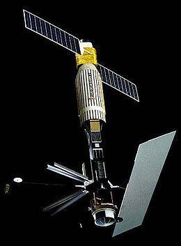
Satellite seasat close to eltanin
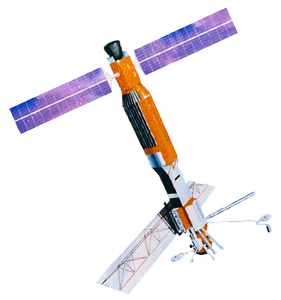
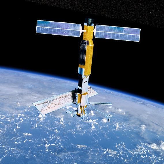
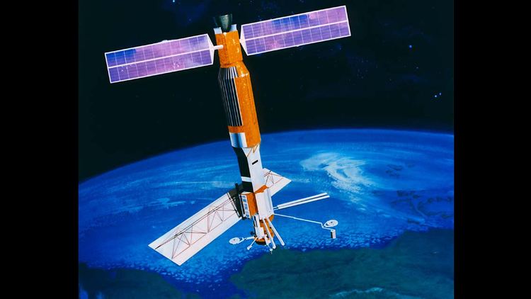
Seasat was the first Earth-orbiting satellite designed for remote sensing of the Earth's oceans and had on board the first spaceborne synthetic aperture radar (SAR). The mission was designed to demonstrate the feasibility of global satellite monitoring of oceanographic phenomena and to help determine the requirements for an operational ocean remote sensing satellite system. Specific objectives were to collect data on sea-surface winds, sea-surface temperatures, wave heights, internal waves, atmospheric water, sea ice features and ocean topography. Seasat was managed by NASA's Jet Propulsion Laboratory and was launched on 27 June 1978 into a nearly circular 800 km orbit with an inclination of 108°. Seasat operated for 106 days until 10 October 1978, when a massive short circuit in the satellite's electrical system ended the mission.
Contents
- Satellite seasat close to eltanin
- Very bright fast seasat satellite spotted over phoenix az 4 19 2012
- Seasat SAR data released in 2013
- Conspiracy theory
- References
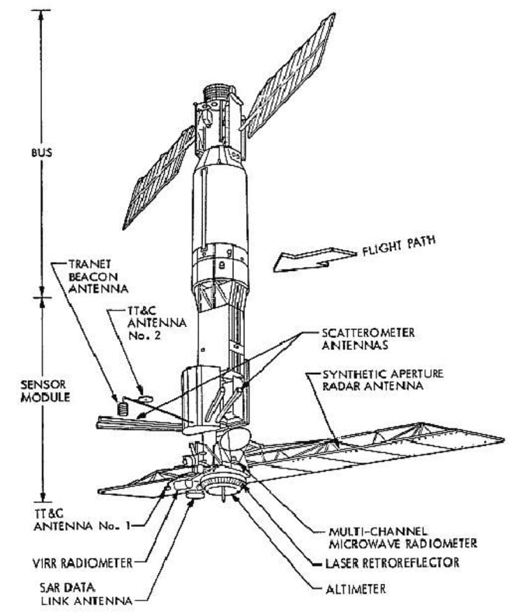
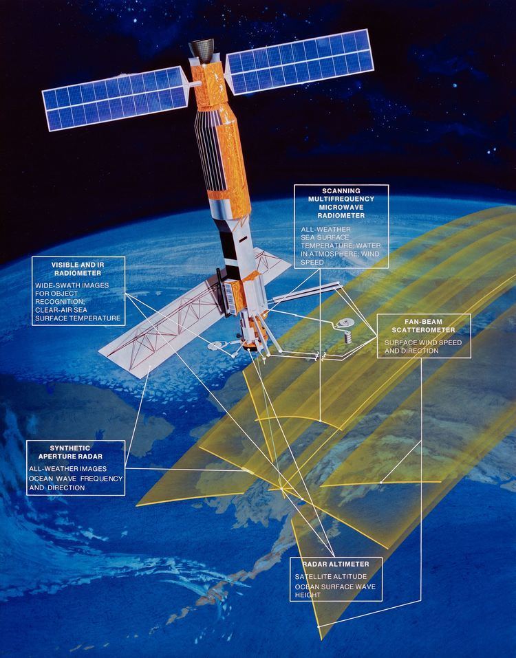
Seasat carried five major instruments designed to return the maximum information from ocean surfaces:
- Radar altimeter to measure spacecraft height above the ocean surface
- Microwave scatterometer to measure wind speed and direction
- Scanning multichannel microwave radiometer to measure sea surface temperature
- Visible and infrared radiometer to identify cloud, land and water features
- Synthetic Aperture Radar (SAR) L-band, HH polarization, fixed look angle to monitor the global surface wave field and polar sea ice conditions {the antenna is the light parallelogram in the picture}. The SAR support structure was designed and manufactured by Northrop Grumman Astro Aerospace in Carpinteria, CA. The structure deployed on orbit.
Many later remote sensing missions owe their legacy to Seasat. These include imaging radars flown on NASA's Space Shuttle, altimeters on Earth-orbiting satellites such as TOPEX/Poseidon, and scatterometers on NASA Scatterometer (NSCAT), QuikSCAT, and Jason 1.
Very bright fast seasat satellite spotted over phoenix az 4 19 2012
Seasat SAR data released in 2013
On the 35th anniversary of Seasat's launch, the Alaska Satellite Facility released newly digitized Seasat synthetic aperture radar (SAR) imagery. Until this release, Seasat SAR data were archived on magnetic tapes, and images processed from the tapes were available only as optical images of film strips or scanned digital images. Neither the tapes nor the film allow the quantitative analysis possible with the new digital archive.
Conspiracy theory
Seasat was able to detect the wakes of submerged submarines, a discovery not anticipated before launch. The conspiracy theory holds that once this was discovered, the military shut SEASAT down, with a cover story of a power supply short.