
 | ||
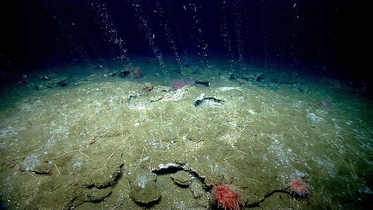
Seafloor mapping, also called seabed imaging, is the measurement of water depth of a given body of water. Bathymetric measurements are conducted with various different methods, ranging from sonar and Lidar techniques to buoys and satellite altimetry. Various methods have advantages and disadvantages and the specific method used depends upon the scale of the area under study, financial means, desired measurement accuracy, and additional variables. Despite modern computer-based research, the ocean seabed in many locations is less measured than the topography of Mars.
Contents
History of seafloor mapping
At the beginning of the twentieth century mapping the seafloor was a very difficult task. The mapping of the sea floor started by using sound waves which were contoured into isobaths and early bathymetric charts of shelf topography provided the first insight into seafloor morphology. Due to horizontal positional accuracy and imprecise depth lead to mapping mistakes. It wasn't until the mid-twenties though, that the first achievements in visualizing the sea and ocean floors was made, when Marie Tharp, working alongside with Bruce Charles Heezen created the first three-dimensional physiographic map of the world's ocean basins in 1997.
Tharp's discovery was made at the perfect time. It was one of many discoveries that took place alongside with the invention of the computer. Computers with their ability to compute large quantities of data have made research conduction much easier. Researching the world oceans is no exception.
There has been a bloom in the underwater environmental exploration, because rather than just creating a map, scientists are trying to visualize the entire crust below in the maximum possible detail. This is where computers are put into good use. With their help researchers have managed to store and compute a large quantity of data enabling them to create the first digital map of the world ocean bed in 1970.The constantly developing technology allows computing to take place in the special equipment required for the so-called "high-resolution orthoimagery" which means that people no longer use sound frequencies to conduct marine exploration.
This method was later upgraded to Airborne Laser Bathymetry (ALB). In other words, this method just improves accuracy in the previous one. Another addition to this way of research is that images are not only of higher quality but have colour as well. The improvements of the research methods and the large amount of data received, stored and computed all lead to the creation of one of the first colour images of the underwater environment created on a computer.
Introduction
Another form of mapping the seafloor is through the utilisation of satellites. The satellites are equipped with hyper-spectral and multi-spectral sensors which are used to provide constant streams of images of coastal areas providing a more feasible method of visualising the bottom of the seabed.
Hyper-spectral sensors
The data-sets produced by Hyper-Spectral (HS) Sensors tend to range between 100-200 spectral bands of approximately 5 - 10 nm bandwidths. Hyper-Spectral Sensing, or imaging spectroscopy, is a combination of continuous remote imaging and spectroscopy producing a single set of data. Two examples of this kind of sensing are AVIRIS (Airborne visible/infrared imaging spectrometer) and HYPERION. More information on Hyper-Spectral Imaging can be found here (Hyperspectral imaging).
The application of HS sensors in regards to the imaging of the seafloor is the detection and monitoring of chlorophyll, phytoplankton, salinity, water quality, dissolved organic materials, and suspended sediments. However this does not provide a great visual interpretation of coastal environments.
Multi-spectral sensors
The other method of satellite imaging, multi-spectral (MS) imaging, tends to divide the EM spectrum into a small number of bands, unlike its partner Hyper-Spectral Sensors which can capture a much larger number of spectral bands. More information on multi-spectral sensing can be found at Multispectral image.
MS sensing is used more in the mapping of the seabed due to its fewer spectral bands with relatively larger bandwidths. The larger bandwidths allow for a larger spectral coverage, which is crucial in the visual detection of marine features and general spectral resolution of the images acquired.
Introduction
High-density airborne laser bathymetry (ALB) is a modern, highly technical, approach to the mapping the seafloor. First developed in the 1960s and 1970s, ALB is a "light detection and ranging (LiDAR) technique that uses visible, ultraviolet, and near infrared light to optically remote sense a contour target through both an active and passive system." What this means is that airborne laser bathymetry uses light outwith the visible spectrum to detect the curves in underwater landscape.
LiDAR
LiDAR, Light Detection and Ranging, is a remote sensing method that uses light in the form of a pulsed laser to measure distances.
These light pulses along with other data generate a three-dimensional representation of whatever the light pulses reflect off giving an accurate representation of the surface characteristics. A LiDAR system usually consists of a laser, scanner, and a GPS receiver. Airplanes and helicopters are the most commonly used platforms for acquiring LIDAR data over broad areas. One application of LiDAR bathymetric LiDAR, which uses water-penetrating green light to also measure seafloor and riverbed elevations. More information on LiDAR can be found here (Lidar).
Execution
ALB generally operates in the form of a pulse of non-visible light being emitted from a low-flying aircraft and a receiver recording two reflections from the water. The first of which originates from the surface of the water, and the second from the seabed. This method has been used in a number of studies to map segments of the seafloor of various coastal areas.
Examples of commercial LIDAR bathymetry systems
There a various LIDAR Bathymetry Systems that are commercially accessible. Two of these systems are Scanning Hydrographic Operational Airborne Lidar Survey (SHOALS) and the Laser Airborne Depth Sounder (LADS). SHOALS was first developed to help the United States Army Corps of Engineers (USACE) in bathymetric surveying by a company called Optech in the 90s. SHOALS is done through the transmission of a laser, of wavelength between 530 and 532 nm, from a height of approximately 200 m at speed of 60 m/s on average.
High resolution orthoimagery
High resolution orthoimagery (HRO) is the process of combining of creating an image that combines the geometric qualities with the characteristics of photographs. The result of this process is an orthoimage, a scale image which includes corrections made for feature displacement such as building tilt. These corrections are made through the use of a mathematical equation, information on sensor calibration and the application of digital elevation models. More information on HRO and high resolution orthoimages can be found at orthophoto.
Execution of HRO
An orthoimage can be created through the combination of a number of photos of the same target. The target is photographed from a number of different angles to allow for the perception of the true elevation and tilting of the object. This gives the viewer an accurate perception of the target area.
Use in seafloor mapping
High resolution orthoimagery is currently being used in the 'terrestrial mapping program', the aim of which is to 'produce high resolution topography data from Oregon to Mexico'. The orthoimagery will be used to provide the photographic data for these regions.