
Length Approx 16.5 km | Trail difficulty Mostly easy | |
 | ||
Hazards Missing sections of trail require navigating back streets. Freeway underpass may flood after heavy rain. No proper crossing on some major roads. Surface Shared use (concrete and asphalt) and residential streets Hills Mostly flat except for a hill at the Wheelers Hill end | ||
The Scotchmans Creek Trail is a shared use path for cyclists and pedestrians, which follows Scotchmans Creek through the eastern suburbs of Melbourne, Victoria, Australia.
Contents
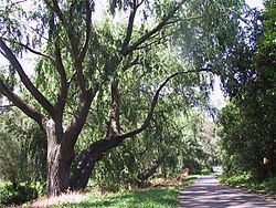
Map of Scotchmans Creek Trail, Victoria, Australia
It runs from East Malvern railway station through to Jells Park although several sections consist of normal residential streets. The trail provides good access to Chadstone Shopping Centre and Holmesglen Institute of TAFE for the local community. The Valley Reserve in Mount Waverley, that the trail runs through, is acknowledged as being one of the last remaining stands of indigenous vegetation in the local area.
Although Scotchmans Creek Trail is widely recognized as ending in the west at East Malvern Railway Station, some sources have the trail's west end at Warrigal Rd.
Signage is confusing as two separate routes are signed. One via Scotchmans Creek and the other via the Pinewood Shopping Centre. Strangely, both routes are signed as the Scotchmans Creek Trail and no indication is given, as to which is the one to make use of or why.
Following the Path
The trail begins in the west at East Malvern Railway Station where it runs alongside the Monash Freeway until it meets Warrigal Road. An overpass takes it to Scotchmans Creek where it continues along the Scotchmans Creek Linear Reserve until it reaches Park Rd. It passes to the north of the Oakleigh Recreation Centre and onwards to Huntingdale Rd where pedestrian lights allow safe crossing. Past the Huntingdale Wetlands it crosses Stanley Ave (and crosses to the north bank of Scotchmans Creek) before going through a tunnel under the Monash Freeway and then under Stephensons Rd. After crossing Forster Rd the path continues to Waverley Rd near Anthony Drive. Previously identified as a "missing link", this section was opened in October 2013, and may be prone to flooding. The alternate route is via Rhonda St and Anthony Drv (see map of the route to take). At Anthony Drv, the trail crosses Waverley road at the east end of traffic island, and continues north-eastward. There is a sign-posted turn off leading to Valley Reserve. The shared use path crosses Blackburn Rd via a footbridge. and finally ends at Waverley Rd near the Homesglen Institute of TAFE, with most of the remaining journey to Jells Park being on residential streets.
After crossing Waverley Rd, turn down Ivanhoe St and follow the path East to Winmalee Dr turn down Koonalda Ave and cross over Springvale Rd at the pedestrian lights (see map of the route to take). A road section at Whites Lane leads to a tennis club. Leave the road for the path at this point. The turn off is very easy to miss. The path continues to Belvedere Ave, Mackintosh Rd and Lum Rd.
There are two options after Lum Rd - either go down Strickland Dr and Clarke Ct or Tom Begg Ct. The trail is steep here as it descends into the Dandenong Valley. A short lane way at the end of each court leads to Sunnybrook Drv. The final section of the path continues to Jells Park (see map of the route to take).
Connections
Note the footbridge over the Monash Freeway was reopened on 20 August 2009.
West end at 37.872810°S 145.068955°E / -37.872810; 145.068955. East end at 37.901598°S 145.201331°E / -37.901598; 145.201331.