
Admin. region Kassel Elevation 280 m (920 ft) Area 36.61 km² Local time Friday 2:49 PM Dialling code 06698 | Time zone CET/CEST (UTC+1/+2) Population 3,262 (30 Jun 2009) Postal code 34637 Administrative region Kassel | |
 | ||
Weather 11°C, Wind NE at 19 km/h, 58% Humidity | ||
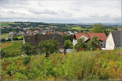
Schrecksbach is a community in the Schwalm-Eder district in Hesse, Germany.
Contents
- Map of Schrecksbach Germany
- Location
- Constituent communities
- History
- Municipal council
- Transport
- References
Map of Schrecksbach, Germany
Location
Schrecksbach lies in the southern part of Schwalm-Eder on the River Schwalm, and forms the border with the Vogelsbergkreis.
Constituent communities
The following centres belong to the greater community::
History
Schrecksbach is a very old place that was mentioned in one of Charlemagne's documents as "Screggesbaha am Sualmanahafluß" as early as 782.
The community itself was first mentioned in 1223.
On 31 October 1806, Napoleon's army overran the country. Elector William I fled and was unseated. At this time, Schrecksbach was occupied by enemy (ie French) troops, suffering heavily as a result.
Municipal council
Municipal council is made up of 23 members.
(as of municipal elections held on 26 March 2006)
Transport
The community is connected to the buslines through the railway stations at Schwalmstadt-Treysa and Alsfeld.