
Demonym(s) Scheggiaioli Postal code 06027 | Elevation 580 m (1,900 ft) Area 63 km² Local time Friday 4:18 AM Dialling code 075 | |
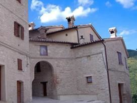 | ||
Frazioni Belvedere, Casacce, Col di Peccio, Isola Fossara, Monte Bollo, Perticano, Pascelupo, Ponte Calcara Weather 6°C, Wind S at 10 km/h, 100% Humidity Points of interest Sant'Emiliano in Congiuntoli, Abbazia di Santa Maria di Sitria, monte Motette | ||
Scheggia e Pascelupo is a comune (municipality) in the Province of Perugia in the Italian region Umbria, located about 40 km northeast of Perugia. The municipal seat is located in the main village of Scheggia, just below Scheggia Pass on Route SS/SR 3, following the ancient Via Flaminia.
Contents
Map of Scheggia e Pascelupo, Province of Perugia, Italy
History
The site was a Roman colony on the Via Flaminia, with a temple of Jupiter of which no traces have been found however. In the Middle Ages it was a possession of Perugia and then of the Montefeltro, until it became part of the Papal States.
Pascelupo, autonomous municipality still 1878, merged into the one Scheggia forming the actual municipality.
Geography
Scheggia e Pascelupo, located close to the borders with the Marche region, borders with the following municipalities: Cantiano (PU), Costacciaro (PG), Frontone (PU), Gubbio (PG), Sassoferrato (AN), and Serra Sant'Abbondio (PU).
The mucipality contains the frazioni (subdivisions, mainly villages and hamlets) of Aiale, Belvedere, Buotano, Campitello, Casacce, Coldipeccio, La Pezza, Montebollo, Monte Fiume, Isola Fossara, Pascelupo, Perticano, Ponte Calcara and Valdorbia.
Main sights
The abbey of Sant'Emiliano in Congiuntoli is situated close to the municipality.