
Prominence 92 m | Elevation 1,968 m | |
 | ||
Normal route via the Füssener Jöchl col Similar Rote Flüh, Läuferspitze, Gimpel, Kellenspitze, Große Schlicke | ||
The Schartschrofen is a rocky summit, 1,968 m high, in the Tannheim Mountains, a sub-group of the Allgäu Alps. It lies northwest of the Rote Flüh and south of the col of Füssener Jöchl.
Contents
AscentEdit
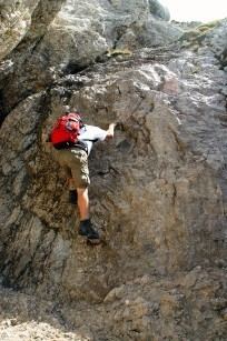
There are two waymarked paths up the Schartschrofen. The normal route runs from the valley of Tannheimer Tal via the col of Füssener Jöchl – to this point the cable car may be taken from Grän – continuing to the Hallgernjoch col and from there to the top. Along the 150-metre-high southeastern arête runs the Friedberger Klettersteig, protected throughout its length, initially leading along the ridge and then after a detour into the south flank finally climbing a gully to the summit.
LiteratureEdit
References
Schartschrofen Wikipedia(Text) CC BY-SA