
Admin. region Oberfranken Municipal assoc. Burgebrach Area 24.67 km² Local time Friday 6:31 PM | Elevation 280 m (920 ft) Population 1,907 (31 Dec 2008) Postal code 96185 | |
 | ||
Weather 11°C, Wind NE at 13 km/h, 65% Humidity | ||
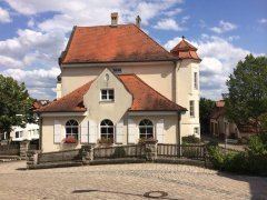
Schönbrunn im Steigerwald (officially: Schönbrunn i.Steigerwald) is a community in the Upper Franconian district of Bamberg and a member of the administrative community (Verwaltungsgemeinschaft) of Burgebrach.
Contents
- Map of 96185 SchC3B6nbrunn im Steigerwald Germany
- Constituent communities
- History
- Population development
- Politics
- Community council
- Economy and infrastructure
- Education
- References
Map of 96185 Sch%C3%B6nbrunn im Steigerwald, Germany
Constituent communities
Schönbrunn’s main and namesake centre is the biggest of its Ortsteile with a population of 916. The community furthermore has these outlying centres, each given here with its own population figure:
The community also has 5 traditional rural land units, known in German as Gemarkungen, named Grub, Halbersdorf, Schönbrunn i.Steigerwald, Steinsdorf and Zettmannsdorf, the same names as 5 of the constituent communities (it is traditional for a Gemarkung to be named after a town or village lying nearby).
History
The Bamberg bishop Berthold von Leiningen (1257–1285) acquired the castle and the village of Schönbrunn in 1280. The Amt established here was bit by bit slowly incorporated into the Amt of Burgebrach between the early 16th and mid 18th century. As part of the High Monastery at Bamberg, it passed with the Reichsdeputationshauptschluss of 1803 to Bavaria. In the course of administrative reform in Bavaria, today’s community came into being under the Gemeindeedikt (“Community Edict”) of 1818.
Population development
Within municipal limits, 1,793 inhabitants were counted in 1970, 1,732 in 1987 and 1,887 in 2000. On 30 June 2007, 1,932 inhabitants were counted. Over the next two and a half years, the population shrank slightly and on 31 December 2006 it was 1,902.
Politics
The mayor is Hans Baier (Bürgerblock).
Community council
The community council is made up of x members, listed here by party or voter community affiliation, and also with the number of seats that each holds:
In 1999, municipal tax revenue, converted to euros, amounted to €621,000 of which business taxes (net) amounted to €98,000.
Economy and infrastructure
According to official statistics, there were 157 workers on the social welfare contribution rolls working in producing businesses, and in trade and transport none. In other areas, 39 workers on the social welfare contribution rolls were employed, and 696 such workers worked from home. In processing businesses there were eight businesses, and in construction six. Furthermore, in 1999, there were 56 agricultural operations with a working area of 1 118 ha, of which 982 ha was cropland and 199 ha was meadowland.
Education
In 1999, the following institutions existed in Schönbrunn im Steigerwald: