
Country Switzerland | ||
 | ||
Similar Klausen Pass, Alps, Schächentaler Windgällen, Gross Windgällen, Clariden | ||
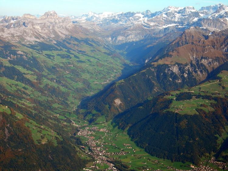
The Schächental is an alpine valley of Uri, Switzerland, formed by the river Schächen. The valley stretches to the east of Altdorf for some 10 km.
Map of Sch%C3%A4chen, Untersch%C3%A4chen, Switzerland
Situated in the Schächental are the municipalities of Bürglen (525 m), Spiringen (923 m) and Unterschächen (995 m). The valley terminates in the Klausenpass (1948 m), which connects to the Urnerboden, leading towards Glarus. A side valley, the Brunnital branches to the south of Unterschächen, extending for some 4 km. It terminates abruptly, in the steep northern slope of the Gross Windgällen.
Upon leaving the valley, the Schächen flows past Altdorf and joins the Reuss at Attinghausen.
The inhabitants of the Schächen valley figure prominently in the formative phase of the Old Swiss Confederacy in the context of the struggle against the Habsburg feudal lords. In legend, William Tell is a native of the Schächen valley.