
Time zone CET (UTC+1) Area 33.31 km² Population 1,023 (1999) | Canton Léré INSEE/Postal code 18246 /18240 Local time Thursday 2:10 PM | |
 | ||
Weather 10°C, Wind S at 10 km/h, 79% Humidity | ||
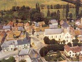
Savigny-en-Sancerre is a commune in the Cher department in the Centre region of France.
Contents
Map of 18240 Savigny-en-Sancerre, France
Geography
A farming area comprising a village and several hamlets situated about 31 miles (50 km) northeast of Bourges, at the junction of the D13 with the D54, D47 and the D152 roads. The commune is the source of many small rivers.
Sights
References
Savigny-en-Sancerre Wikipedia(Text) CC BY-SA