
 | ||
Sattagydia
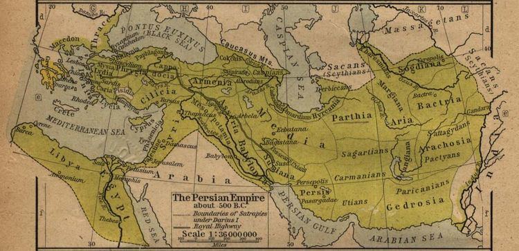
Sattagydia (Old Persian Thataguš, country of the "hundred cows") was one of the easternmost satrapies of the Achaemenid Empire, situated east of the Kirthar Mountains on the Indus River, corresponding approximately to southern Indoscythia and to the current Sindh region of Pakistan. It was bounded on the west by Gedrosia, on the north by Arachosia and on the south and east by the Kingdoms of Ancient India.
Contents
Sattagydia is mentioned for the first time in the Behistun inscription of Darius the Great as one of the provinces in revolt while the king was in Babylon. The revolt was presumably suppressed in 515 BCE. The satrapy disappears from sources after 480 BCE, possible being mentioned by another name or included with other regions.
After being conquered by Alexander the Great, Sattagydia became part of the Seleucid Empire. Under the Seleucids this area was adjacent to Sind, which was itself adjacent to Abiria (corresponding roughly to Rajasthan), with the coastal region being called Syrastrene. The area was taken from the Seleucids by the Mauryans under Chandragupta in 316 BCE. And, beginning in the 1st century b.C., the area was incorporated into the burgeoning Kushan empire, referred to as "Scythia" in the Periplus.