
Arabic صطاف Population 540 (1945) Phone +972 1-800-350-550 | Name meaning from a personal name Palestine grid 162/130 | |
 | ||
Address Akhvat Akhim Forest, Tzova, Israel | ||
Ein sataf boys 2014
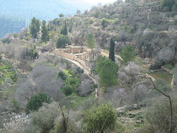
Sataf (Arabic: صطاف, Hebrew: סטף) is a tourist site showcasing ancient agricultural techniques used in the Jerusalem Mountains. Before 1948 it was a Palestinian Arab village in the Jerusalem Subdistrict depopulated during the 1948 Arab–Israeli War. It is located 10 km west of Jerusalem, with Sorek Valley (Arabic: Wadi as-Sarar) bordering to the east.
Contents
- Ein sataf boys 2014
- Sdei chemed girls 2006 nachal sataf
- Chalcolithic period
- Byzantine period
- Mamluk period
- Ottoman period
- British Mandate period
- 1948 War and aftermath
- References
Two springs, Ein Sataf and Ein Bikura flow from the site into the riverbed below.
A monastery located across the valley from Sataf, i.e. south of Wadi as-Sarar, known by local Arabs as Ein el-Habis (the "Spring of the Hermitage"), is officially called Monastery of St. John in the Wilderness.
Sdei chemed girls 2006 nachal sataf
Chalcolithic period
Remains of a 4,000 BCE Chalcolithic village were discovered at the site. The related traces of agricultural activities number among the oldest in the region.
Byzantine period
Most ancient remains date to the Byzantine period.
Mamluk period
The first written mention of the site is from the Mamluk era.
Ottoman period
In the late Ottoman period, in 1863, Victor Guérin described a village of one hundred and eighty people. He further noted that their houses were standing on the slopes of a mountain, and that the mountainside was covered by successive terraces. An Ottoman village list from about 1870 counted 38 houses and a population of 115, whereby only men were counted.
In 1883, the Palestine Exploration Fund's Survey of Western Palestine described Setaf as "a village of moderate size, of stone houses, perched on the steep side of a valley. It has a spring lower down, on the north."
British Mandate period
By the 1922 census of Palestine conducted by the British Mandate authorities, Sataf had a population of 329; 321 Muslims and 8 Christians. All the Christians were Roman Catholic. The 1931 census lists 381 inhabitants; 379 Muslim and 2 Christian, in a total of 101 houses.
In 1945 the population of Sataf was 540, all Muslims, and the total land area was 3,775 dunams, according to an official land and population survey. Of this, 928 dunams were plantations and irrigable land, 465 for cereals, while 22 dunams were built-up land.
1948 War and aftermath
On July 13–14, 1948 the Arab village was depopulated by the Har'el Brigade, during Operation Dani. Sataf and the surrounding area became part of the newly created State of Israel.
A short time after the 1948 War, a small group of Jewish immigrants from North Africa settled for a few months in the village area. Subsequently the IDF's Unit 101 and paratroopers used it for training purposes. In the 1980s the Jewish National Fund began the restoration of ancient agricultural terraces, and the area around the springs has been turned into a tourist site. A forest around the site was also planted by the Jewish National Fund.
In 1992, Sataf was described as follows: "Many half-destroyed walls still stand, and some still have arched doorways. The walls of a few houses with collapsed roofs are almost intact....The area around the village spring, which is located to the east next to the ruins of a rectangular stone house, has been turned into an Israeli tourist site. A Jewish family has settled on the west side of the village, and have fenced in some of the village area."