
Length 13 kilometres (8 mi) Area 30 km² | Status Receding | |
 | ||
Similar Rocky Mountains, Waputik Icefield, Canadian Rockies, Crowfoot Glacier, Mount Saskatchewan | ||
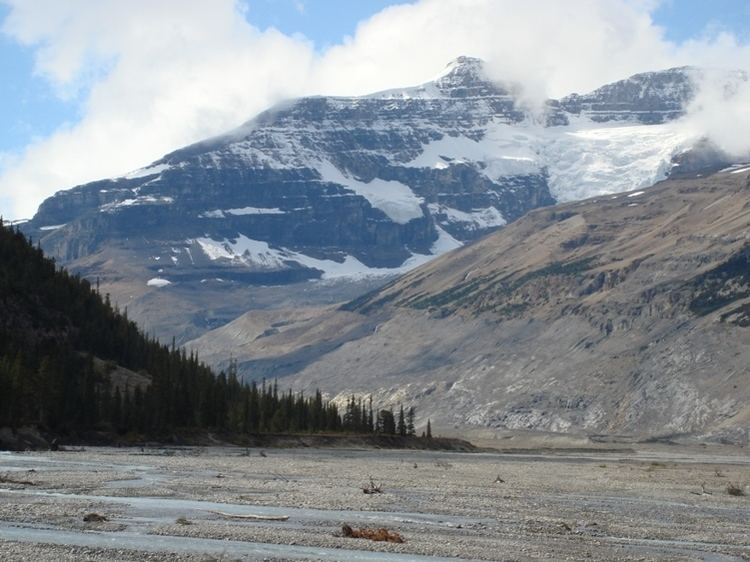
Hiking to saskatchewan glacier
The Saskatchewan Glacier is located in Banff National Park, Alberta, Canada, approximately 120 km (75 mi) northwest of the town of Banff, and can be accessed from the Icefields Parkway. Saskatchewan Glacier is the largest outflow glacier from the Columbia Icefield, which rests along the Continental Divide. The glacier is a primary water source for the North Saskatchewan River. The glacier is approximately 13 kilometres (8.1 mi) long and covers an area of 30 km² (11.5 mi²) and was measured in 1960 to be over 400 metres (1,300 ft) thick at a distance of 8 kilometres (5.0 mi) from the terminal snout. Between the years 1893 and 1953, Saskatchewan Glacier had retreated a distance of 1,364 metres (4,475 ft), with the rate of retreat between the years 1948 and 1953 averaging 55 metres (180 ft) per year.
Contents
- Hiking to saskatchewan glacier
- Map of Saskatchewan Glacier Improvement District No 9 AB Canada
- Saskatchewan glacier from parker s ridge
- References