
Capital Sarpang | ||
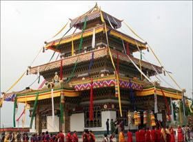 | ||
Sarpang District (Dzongkha: གསར་སྤང་རྫོང་ཁག་; Wylie: Gsar-spang rdzong-khag; also known as "Geylegphug") is one of the 20 dzongkhags (districts) comprising Bhutan.
Contents
Map of Sarpang, Bhutan
Languages
The dominant language in Sarpang is Nepali, an Indo-European language spoken by the heterogeneous Lhotshampa community. The East Bodish Kheng language is also spoken in the northeastern reaches of the district.
Administrative divisions
Sarpang District is currently divided into twelve village blocks (or gewogs):
Environment
Much of Sarpang District consists of environmentally protected areas. Far western Sarpang District (the gewog of Senghe) contains part of the uninhabited Phibsoo Wildlife Sanctuary along the India border; northern Sarpang District (the gewog of Jigmechhoeling) is part of Jigme Singye Wangchuck National Park; eastern and southeastern Sarpang District (the gewogs of Jigmechhoeling, Tareythang and Umling) lie within Royal Manas National Park. Sarpang is bisected by a wide swath of biological corridor connecting all three environmentally protected areas.
History
On April 26, 2007 Lhamoy Zingkha Dungkhag (sub-district) was formally transferred from Sarpang Dzongkhag to Dagana Dzongkhag, affecting the town of Lhamozingkha and three gewogs – Lhamoizingkha, Deorali and Nichula Gewogs (Zinchula) – that formed the westernmost part of Sarpang and became the southernmost part of Dagana.