
Arabic ساريس Subdistrict Jerusalem Area 10,699 dunams Current localities Shoresh, Sho'eva | Name meaning Saris, personal name Palestine grid 157/133 Date of depopulation 17 April 1948 | |
 | ||
Cause(s) of depopulation Military assault by Yishuv forces Weather 12°C, Wind N at 2 km/h, 68% Humidity | ||
Recycled saris from bangladesh
Saris (Arabic: ساريس) was a Palestinian Arab village that was depopulated during the major offensive launched by the Haganah on 6 April 1948. Called Operation Nachshon, and launched before the British had left Palestine, its objective was to capture villages between Jerusalem and the coastal plain.
Contents
- Recycled saris from bangladesh
- Palestinian arab village saris
- History
- Ottoman era
- British Mandate era
- 1948 and after
- References
Palestinian arab village saris
History
Yaqut al-Hamawi noted about Saris in the 1220s that it was "a village of the district round Jerusalem. It lies half-way between Jerusalem and Ar Ramlah, and 4 hours from either place".
Ottoman era
During Ottoman rule in Palestine, in 1596, Saris was a village in the nahiya (subdistrict) of Jerusalem under the liwa' (district) of Jerusalem and it had a population of 292. The villagers paid taxes on a number of crops, including wheat, barley, olives fruit and carob, as well as on goats, beehives and vineyards.
In 1863, the French explorer Victor Guérin found Saris to have an apparently ancient water well, while the houses looked "dilapidated". An Ottoman village list of about 1870 counted 57 houses and a population of 169, though the population count included only men.
In 1883, the Palestine Exploration Fund's Survey of Western Palestine described Saris as being located on top of a hill, with olive trees growing below the village.
British Mandate era
In the 1922 census of Palestine conducted by the British Mandate authorities, Saris had a population 373, all Muslims, increasing in the 1931 census to 470, still all Muslims, in 114 houses.
In 1945 the population of Saris was 560, all Muslims, and it had 10,699 dunams of land according to an official land and population survey. 366 dunams were plantations and irrigable land, 3,677 for cereals, while 10 dunams were built-up (urban) land.
1948 and after
On 13 April, before the village was attacked, Israel Galili wrote to Yosef Weitz of the JNF asking for a settlement to be established at Saris 'as soon as possible.'
The Scotsman, Saturday 17 April 1948, reported 'Jews destroyed a mosque, village school, and 25 houses, killing three women in an attack on the Arab village of Saris early today (16th). There were about 500 attackers.' The New York Times carried the same report and gave the number of Arab dead as seven. A Haganah statement is quoted as saying that the battalion stayed in the village for about five hours, blowing up 25 buildings and burning others.
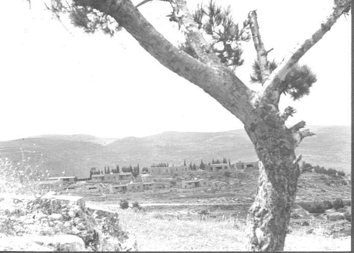
The village of Shoresh was established 1 km south west of the remains of Saris in 1948. Sho'eva was set up 0.5 km north east of the site in 1950. Both are on village land.
The Palestinian historian Walid Khalidi described the village land in 1992: "The site is covered with stone rubble; iron bars protrude from the collapsed roofs. There are many open wells and several caves with arched roofs. A large number of trees, including cypress, fig, and almond trees, grow on the site. An abandoned grove of almond trees is located on the eastern side. In the middle of the slope are the remains of an artificial pool. The village cemetery, surrounded by trees, is located southwest of the site. It contains several large tombs, one of which is surrounded by a small, roofless enclosure; an almond tree grows in the center. The Shoresh forest, named after the Israeli settlement, was established by the youth of the Jewish National Fund in Johannesburg, South Africa. Another forest in the area, dedicated to several notable Jews, have been planted under the auspices of the Center for European Jewry.