
Country France Department Pyrénées-Atlantiques Intercommunality Sud Pays Basque Area 51.34 km² Local time Wednesday 7:36 PM | Region Nouvelle-Aquitaine Canton Espelette Time zone CET (UTC+1) Population 2,184 (1999) Arrondissement Bayonne | |
 | ||
Weather 7°C, Wind NE at 8 km/h, 98% Humidity Points of interest Cuevas de Sare, Parc Animalier Etxola, Ortillopitz, Col de Lizarrieta, The Train of La Rhune | ||
Sare (Basque: Sara) is a village in the traditional Basque province of Labourd, now a commune in the Pyrénées-Atlantiques department in south-western France on the border with Spain. It is backed by the Pyrenean mountain range, which forms a basin around the village open to the east and the north. Its geological history explains the formation of caves that were occupied by the Aurignacian. The Bronze Age left a number of funerary monuments on the slopes and mountain plateaus of the region. Today, it's territory forms an enclave in the Navarre, a region of Spain, with which it shares a 25 km border. This in particular has had significant consequences on the history of the village, with centuries of pastoral agreements with neighbouring Spanish villages. During the Peninsular War the Anglo-Portuguese Army led by the future Duke of Wellington breached the frontier and repelled the French troops who had stationed themselves in forts on La Rhune.
Contents
Map of 64310 Sare, France
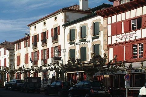
The village contains many old buildings with around 283 houses identified by as dating partially as far back as the 15th century. The traditional architecture of these buildings, their exterior decorations and the orientation defines the archetype of the rural house that exists in the popular image of the "Basque House". The population of Sare has remained stable for 200 years. Since 1793 the only real development that has occurred began in 1990, and the population reached more than 2500 people in the 2010s. Agricultural activity remains are constant element of the town's economy, even though the location has hosted mining industries since the Middle Ages, and more recently a wool treatment mill. The proximity of the border with Spain and the configuration of the terrain and the roadways as well as the shared Basque languages have given birth to a local economy shared between Spain and France characterised by smuggling.
It is located some 15 km (9.3 mi) to the east of Saint-Jean-de-Luz and the Atlantic Ocean, in the western foothills of the Pyrenees.
The summit of La Rhune, a mountain iconic of the Basque country, is situated approximately 4 km (2.5 mi) to the west of the village. The summit can be reached by the Petit train de la Rhune, which commences from the Col de Saint-Ignace, 3.5 km (2.2 mi) to the west of the village on the D4 road to Saint-Jean-de-Luz.