
Time zone PST (UTC+5) | ||
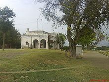 | ||
Sarai saleh dorr gaar haripur hazara www hazaratoday com
Sarai Saleh (Urdu: سرائے صالح) is one of the 44 union councils (administrative subdivisions) of Haripur District in the Khyber Pakhtunkhwa province of Pakistan.
Contents
- Sarai saleh dorr gaar haripur hazara www hazaratoday com
- Map of Sarai Saleh Pakistan
- Sarai saleh haripur pakistan mp4
- Language
- Education
- References
Map of Sarai Saleh, Pakistan
Sarai Saleh is located 5 kilometers northeast of Haripur City and is 597 meters above sea level. It is a mostly green valley surrounded by hills covering an area of two to three square kilometers. It is situated on Shahr-e-Resham River and is served by a 1928 train station.
The oldest tribes of the town are Utmanzae and dilazak.Most of the Dilazaks returned during the reign of the Mughal Emperor Shah Jahan (January 5, 1592 – January 22, 1600), and settled in parts of Khyber Pakhtoonkhwa Province and Punjab Province of Pakistan in their old lands. One of them, Saleh Khan, settled with his family in Sara-e-Saleh and Tir, both in Haripur District of Khyber Pakhtoonkhwa Province in Pakistan.
Sarai saleh haripur pakistan mp4
Language
The primary language spoken in the region is Hindko. Pahaari is spoken by some inhabitants, generally only in private.
Education
Sarai Saleh has a high literacy rate, 76% in males 61% in females. Government and private educational institutes are located there.