
Time zone EET (UTC+2) Area 280 km² Area code 0382 | Region Central Anatolia Elevation 870 m (2,850 ft) Postal code 68xxx Local time Thursday 2:17 AM | |
 | ||
Weather 3°C, Wind NE at 16 km/h, 62% Humidity | ||
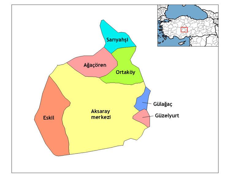
Sarıyahşi is a town and district of Aksaray Province in the Central Anatolia region of Turkey, at a distance of 110 km (68 mi) from the province seat of Aksaray. According to 2000 census, population of the district is 12,120 of which 7,751 live in the town of Sarıyahşi, and the remainder in surrounding villages. The district covers an area of 280 km2 (108 sq mi), and lies at an average elevation of 870 m (2,854 ft).
Map of Sar%C4%B1yah%C5%9Fi, 68700 Sar%C4%B1yah%C5%9Fi%2FAksaray, Turkey
The district is good agricultural land watered by Hirfanlı Dam reservoir, and used for growing grain and other crops. There is a uranium mine in the village of Bekdik and various stone quarries.
The town of Sarıyahşi is a small rural centre providing schools and other basic amenities to the surrounding countryside.
References
Sarıyahşi Wikipedia(Text) CC BY-SA