
Time zone IST (UTC+5:30) Elevation 140 m Local time Wednesday 1:44 PM | Ward 7 Area 16 km² Population 19,465 (2011) | |
 | ||
Samtrampur Nagarpalika Established 15 April,1994 Weather 38°C, Wind SW at 6 km/h, 16% Humidity | ||
Santrampur, which used to be known as Brahampuri, is a historical town of Mahisagar District in Gujarat State of India. It serves as administrative headquarter of santrampur tehsil. The town surrounded by verdurous greenery, is situated in the lap of aravalli hill ranges. It was built in 1255 AD.
Contents
- Map of Santrampur Gujarat 389260
- Visitor attractions
- Demographics
- Princely State of Sant
- Ranas
- References
Map of Santrampur, Gujarat 389260
Visitor attractions
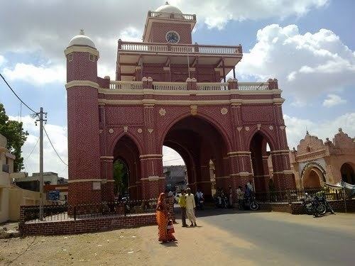
- Hava Mahel
- Mangadh Hill
- Kadana Dam
- Maa Bhuvneswari Temple
- Maa Harsiddhi Temple
- Fair Of Ravadi
- Sagdapada Village
- fair of aamli (batakvada)
Demographics
As of 2011 India census, Santrampur had a population of 19,465. Population of Children with age of 0-6 is 2511 which is 12.90 % of total population of Santrampur. In Santrampur , Female Sex Ratio is of 934 against state average of 919. Literacy rate of Santrampur city is 84.99 % higher than state average of 78.03 %. In Santrampur, Male literacy is around 91.58 % while female literacy rate is 78.03 %.
Princely State of Sant
Before 1947, Santrampur was the seat of the princely state of Sant, which was merged with the Dominion of India on 10 June 1948. The state was ruled by the Hindu Parmar clan of Rajputs.