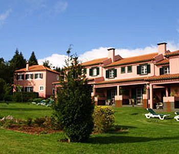
- elevation 667 m (2,188 ft) Area 14.77 km² | ||
 | ||
- location Estrada Santo António da Serra | ||
Santo António da Serra is a civil parish in the municipality of Santa Cruz in the Portuguese autonomous region of Madeira. The parish is adjacent to another parish in the neighbouring municipality of Machico to the north, which is also named Santo António da Serra. The population in 2011 was 936, in an area of 14.75 km².
Contents
Map of Santo Ant%C3%B3nio Da Serra, Portugal
Geography
It is located west of Machico and east-northeast of the regional capital of Funchal.
References
Santo António da Serra (Santa Cruz) Wikipedia(Text) CC BY-SA
