
Country São Tomé and Príncipe Time zone UTC (UTC+0) Population 1,357 (2013) Province Príncipe Province | District Pagué Elevation 204 m Local time Wednesday 6:48 AM | |
 | ||
Weather 27°C, Wind S at 14 km/h, 82% Humidity | ||
Santo ant nio pr ncipe carnival
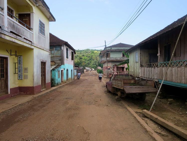
Santo António is the main settlement of Príncipe Island in São Tomé and Príncipe and was the colonial capital of Portuguese São Tomé and Príncipe from 1753 until 1852. It lies on the north east coast and the Palhota River. It serves as the capital of both Príncipe Province and Pagué District and has an estimated population of 1,200 residents.
Contents
- Santo ant nio pr ncipe carnival
- Map of Santo Antonio SC3A3o TomC3A9 and PrC3ADncipe
- Transportation
- International relations
- References
Map of Santo Antonio, S%C3%A3o Tom%C3%A9 and Pr%C3%ADncipe
The town is known for its colonial architecture and for its churches, the largest of which is the main Roman Catholic church, begun in 1947. The town is also known for the Auto da Floripes play, which is performed by the citizens and watched by people coming from all over the world.
Transportation
Santo António is linked with remote unpaved roads that link to the northern and the southern part of the island as well as to near the mountain.
Santo António has a school or a collegiate (colegio), churches, beaches, a small port and a few squares (praças).The local currency is the dobra.
International relations
Santo António is twinned with: