
Demonym(s) Santasofiesi Local time Wednesday 4:41 AM | Region Emilia–Romagna Elevation 257 m (843 ft) Area 148.5 km² Patron saint Saint Lucy | |
 | ||
Frazioni Berleta, Biserno, Bleda, Burraia, Cabelli, Campigna, Camposonaldo, Chalet Burraia, Collina di Pondo, Corniolo, Isola, Monte Falco, Rifugio La Capanna, San Martino, Spinello Weather 9°C, Wind SW at 11 km/h, 90% Humidity | ||
Santa sofia emilia romagna
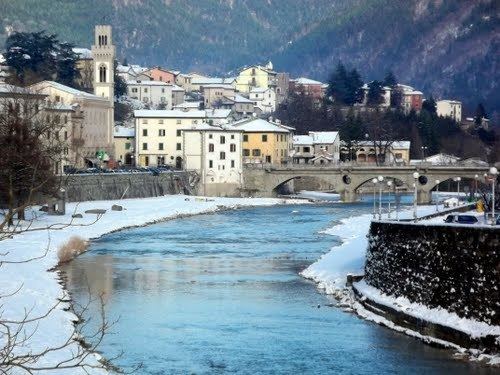
Santa Sofia is a comune (municipality) in the Province of Forlì-Cesena in the Italian region Emilia–Romagna, located about 80 kilometres (50 mi) southeast of Bologna and about 35 kilometres (22 mi) southwest of Forlì.
Contents
- Santa sofia emilia romagna
- Map of 47018 Santa Sofia Province of ForlC3AC Cesena Italy
- Main sights
- Notable people
- References
Map of 47018 Santa Sofia Province of Forl%C3%AC-Cesena, Italy
Santa Sofia borders the following municipalities: Bagno di Romagna, Civitella di Romagna, Galeata, Pratovecchio, Premilcuore, San Godenzo, Sarsina, Stia.
Main sights
Santa Sofia is located within the Foreste Casentinesi, Monte Falterona, Campigna National Park.
Sights include:
Notable people
Nicoli Marchiano Italiano diplomate Migel Marchiano Assistant to the diplomate
References
Santa Sofia, Emilia–Romagna Wikipedia(Text) CC BY-SA