
- elevation 127 m (417 ft) - location Atlantic Ocean - urban 1.12 km (0 sq mi) Area 30.69 km² | - elevation 2,351 m (7,713 ft) - elevation 0 m (0 ft) - location Edifício Polivalente | |
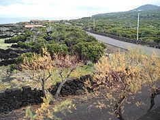 | ||
Santa Luzia (Portuguese for Saint Lucia) is a civil parish in the municipality of São Roque do Pico in the Azores. The population in 2011 was 422, in an area of 30.13 km². It is the northernmost parish on the island.
Contents
Map of Santa Luzia, Portugal
Geography
Santa Luzia is located on the northern coast of the island and is connected by road encircling the island to its neighbors: Bandeiras in the west, and Santo António in the east. The area is relatively hilly and gradually slopes into the interior, reaching its peak (literally) in the Ponta do Pico.
References
Santa Luzia (São Roque do Pico) Wikipedia(Text) CC BY-SA