
Country Spain Time zone CET (UTC+0) Elevation 680 m Population 68,544 (2014) | Postal code 35110 Area 61.56 km² Local time Wednesday 12:39 AM Area code 928 | |
 | ||
Weather 12°C, Wind N at 29 km/h, 78% Humidity | ||
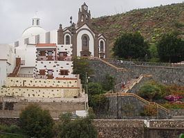
Santa Lucía de Tirajana is a town and a Spanish municipality in the south-eastern part of the island of Gran Canaria, in the Province of Las Palmas, in the Canary Islands.
Contents
Map of 35280 Santa Luc%C3%ADa de Tirajana, Las Palmas, Spain
Geography
The town of Santa Lucía de Tirajana is situated in the mountains, 27 km (17 mi) south-west of Las Palmas. Its population is 68,506 (2013), and the area is 61.56 km2 (23.77 sq mi).
The municipality includes the larger towns Cruce de Sardina, El Doctoral and Vecindario, located near the coast.
The GC-1 passes through the south-eastern part of the municipality.
Heritage sites
The archaeological site La Fortaleza is listed as a Property of cultural interest.
There are nine water mills dating from the 19th century, built on the Riego de la Zarcilla river. Most of them kept working up to the 1970s. Since then, many fell into disrepair. Ownership may be public or private. On the municipality, the two mills of El Valle (olive oil for one and gofio for the other) were declared properties of cultural interest in 2003. D. Benjamín González Araña, who owns the olive oil mill, had its restoration completed in 2004. The council of Gran Canaria had the gofio mill repaired in 2003.