
Country Philippines Barangays ZIP code 8512 Province Agusan del Sur | Region Caraga (Region XIII) Time zone PST (UTC+8) Area 341.8 km² Local time Wednesday 8:29 AM | |
 | ||
District 2nd district of Agusan del Sur Weather 27°C, Wind N at 6 km/h, 83% Humidity | ||
Santa Josefa, officially the Municipality of Santa Josefa (Cebuano: Lungsod sa Santa Josefa; Filipino: Bayan ng Santa Josefa), is a municipality in the province of Agusan del Sur in the Caraga (Region XIII) of the Philippines. The population was 26,729 at the 2015 census. In the 2016 electoral roll, it had 17,085 registered voters.
Contents
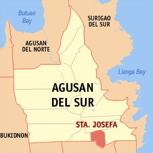
- Map of Santa Josefa Agusan del Sur Philippines
- Geography
- Climate
- Barangays
- Demographics
- Economy
- References
Map of Santa Josefa, Agusan del Sur, Philippines
Geography
Santa Josefa is located at 7°59′N 126°02′E.
According to the Philippine Statistics Authority, the municipality has a land area of 341.8 square kilometres (132.0 sq mi) constituting 7000342000000000000♠3.42% of the 9,989.52-square-kilometre- (3,856.98 sq mi) total area of Agusan del Sur.
Climate
Santa Josefa is classified as Type II climate which has no dry season but with pronounced maximum rain period occurring from December to January.
Barangays
Santa Josefa is politically subdivided into 11 barangays.
Demographics
In the 2015 census, Santa Josefa had a population of 26,729. The population density was 78 inhabitants per square kilometre (200/sq mi).
In the 2016 electoral roll, it had 17,085 registered voters.
Economy
Santa Josefa's main products are rice and corn.