
Country United States Population 179,590 (2013) Unemployment rate 7.0% (Feb 2015) Area 62.16 sq mi | State Mayor Marsha McLean | |
Recent posts on Google+ Points of interest Six Flags Magic Mountain, Superman: Escape from Krypton, Green Lantern: First Flight (Six Flags Magic Mountain), Goldrusher, X2 Colleges and Universities College of the Canyons, California Institute of the Arts, The Masters College, Charter College - Canyon Country, Clarita Career College | ||
Santa Clarita, officially the City of Santa Clarita, is the third largest city in Los Angeles County, California, United States and the eighteenth largest in the state of California. The city has annexed a number of unincorporated areas, contributing to the large population increase. It is located about 35 miles (56 km) northwest of downtown Los Angeles, and occupies most of the Santa Clarita Valley. It is a notable example of a U.S. edge city or boomburb. Santa Clarita was ranked by Money magazine in 2006 as 18th of the top 100 places to live.
Contents
- Map of Santa Clarita California
- Visit santa clarita
- For rent 15706 kenneth place canyon country ca 91387 santa clarita property management
- History
- Geography
- Economy
- Santa clarita valley top 10 breakfast spots
- References
Map of Santa Clarita, California
Santa Clarita was incorporated in December 1987 as the union of several previously existing communities, including Canyon Country, Newhall, Saugus, and Valencia, all of which are situated on the land of the former Rancho San Francisco. It is bounded on the west by the Golden State Freeway (I-5). The Antelope Valley Freeway (SR-14) runs northeast-southwest through an irregular east border, and the Newhall Pass is the citys southernmost point.
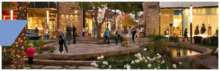
Visit santa clarita
Santa Clarita is often associated with the Six Flags Magic Mountain amusement park, though the park is located just outside the city limits, and the California Institute of the Arts (CalArts), located in Valencia.
For rent 15706 kenneth place canyon country ca 91387 santa clarita property management
History
Santa Clarita was incorporated in December 1987, but its history stretches back several centuries. About AD 450, the Tataviam arrived, numbering around 2,000 at their zenith.
In 1842, Francisco Lopez made the first "documented" discovery of gold in California. The event is memorialized in an 1842 mining claim issued by Gov. Juan B. Alvarado. The discovery was made in Placerita Canyon, an area later used as Hollywoods original back lot.
The community of Newhall is named after Henry Newhall, a businessman who made his original fortune during the California Gold Rush after opening up the H.M. Newhall & Company, an extremely successful auction house in San Francisco. Newhalls next business interest was railroads. He invested in rail companies that would connect San Francisco to other cities and became president of the San Francisco and San Jose Railroad. In 1870, he and his partners sold the company to Southern Pacific Railroad, on whose board of directors he then sat. After railroads, Newhall turned his eye to real estate and ranching. He purchased a number of the old Spanish and Mexican land grants in the state for a total of 143,000 acres (58,000 ha) between Monterey and Los Angeles counties. The most significant portion was the 46,460 acres (18,800 ha) Rancho San Francisco in northern Los Angeles County, which he purchased for $2/acre, and which became known as Newhall Ranch after Newhalls death. Within this territory, he granted a right-of-way to Southern Pacific through what is now Newhall Pass, and he also sold them a portion of the land, upon which the company built a town they named after him: Newhall. The first station built on the line he named for his hometown, Saugus, Massachusetts. Following his death, Newhalls heirs incorporated the Newhall Land and Farming Company, which oversaw the development of the communities that now make up the city of Santa Clarita.
On September 26, 1876, Charles Alexander Mentry brought in the states first productive oil well at Mentryville, giving rise to the California oil industry. The oil was brought to a refinery at Newhall, now the oldest existing petroleum refinery in the world: It was operational from 1874 to 1888.
A few days earlier, on September 5, 1876, Charles Crocker and Leland Stanford joined their railroads in Canyon Country, linking Los Angeles with the rest of the nation for the first time.
The Saugus Cafe, on Railroad Avenue in Saugus, was established in 1887 and appears to be, by far, the oldest still-operating restaurant in Los Angeles County.
Filming in Santa Clarita began shortly after the turn of the 20th century with a veritable Whos Who of actors, including William S. Hart, Tom Mix, Harry Carey and a young John Wayne. Hart and Carey made their homes in the Santa Clarita Valley; today both are operated as county parks.
The Santa Clarita Valley was the scene of the second worst disaster in Californias history in terms of the number of lives lost. Known as the "worst civil engineering failure of the 20th century". Shortly before midnight on March 12, 1928, the St. Francis Dam collapsed. By the time the floodwaters reached the Pacific Ocean near Ventura five hours later, nearly 600 people were dead. Within modern Santa Clarita city limits, the present day site of the Westfield Valencia Town Center mall would have been buried beneath muck, mud and debris. Numerous buildings in Newhall became makeshift morgues.
After numerous failed attempts to form a city and at least two failed attempts to form a separate county, the people of the Santa Clarita Valley finally succeeded in incorporating the City of Santa Clarita at 4:30 PM on December 15, 1987 after voting in favor of incorporation by a margin of two to one in that years general election. The other proposed name for the new city, which was narrowly defeated, was "City of the Canyons."
Geography
Santa Clarita, according to the United States Census Bureau, has a total area of 62.16 square miles (161.0 km2), of which 62.10 square miles (160.8 km2) is land and 0.06 square miles (0.16 km2) (0.099%) is water.

Santa Clarita is situated near the San Fernando fault zone and was affected by the 1971 San Fernando earthquake, also known as the Sylmar quake. The city was also affected by the 1994 Northridge earthquake, and many commercial and residential buildings were devastated by its aftermath, including the nearby Newhall Pass, the Valencia Town Center, and Six Flags Magic Mountain. The 38 story tall Sky Tower at Magic Mountain swayed six feet in each direction during the Northridge earthquake with only minor damage.
Economy
Princess Cruises and MannKind are based in Santa Clarita. Sunkist has moved its regional headquarters from Sherman Oaks to Santa Clarita.