
Demonym(s) Santagatesi Local time Tuesday 9:31 PM Postal code 61019 | Elevation 606 m (1,988 ft) Patron saint Agatha of Sicily | |
 | ||
Frazioni Botticella, Palazzo, Pereto, Petrella Guidi, Poggio Scavolo, Rivolpaio, Rocca Pratiffi, Romagnano, Rosciano, San Donato, Sapigno, Tramonto, Ugrigno Weather 9°C, Wind NE at 5 km/h, 83% Humidity | ||
Sant agata feltria il paese del natale hd
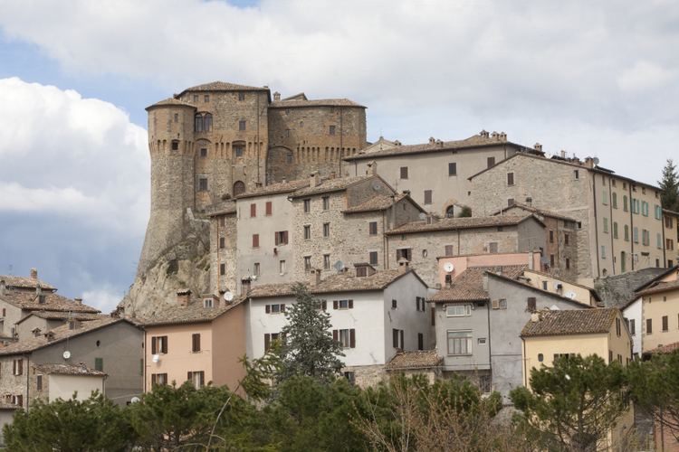
Sant'Agata Feltria is a comune (municipality) in the Province of Rimini in the Italian region Emilia-Romagna, located about 125 kilometres (78 mi) southeast of Bologna and about 45 kilometres (28 mi) south of Rimini.
Contents
- Sant agata feltria il paese del natale hd
- Map of 47866 SantAgata Feltria Province of Rimini Italy
- Overview
- History
- References
Map of 47866 Sant'Agata Feltria Province of Rimini, Italy
Overview
It is home to a large fortress (Fortilizio), designed, among the others, by Francesco di Giorgio Martini
History
After the referendum of 17 and 18 December 2006, Sant'Agata Feltria was detached from the Province of Pesaro and Urbino (Marche) to join Emilia-Romagna and the Province of Rimini on 15 August 2009.
References
Sant'Agata Feltria Wikipedia(Text) CC BY-SA